
Population 409 (2011 Census) Civil parish Ludgershall Local time Tuesday 4:44 PM | OS grid reference SP661174 Sovereign state United Kingdom Dialling code 01844 | |
 | ||
Weather 14°C, Wind W at 13 km/h, 76% Humidity | ||
Ludgershall is a village and civil parish in the Aylesbury Vale district of Buckinghamshire, England. It is near the boundary with Oxfordshire, about 5.5 miles (9 km) south-east of Bicester and 5 miles (8 km) west of Waddesdon.
Contents
Map of Ludgershall, Aylesbury, UK
Toponym
The toponym is said to be derived from the Old English for "nook with a trapping spear" but this is disputed. It occurs in more than one place in England (see Ludgershall (disambiguation)). The Domesday Book of 1086 records the village as Litlegarsele. The place spelt at Lotegarshale, seen in 1381, may refer to the Buckinghamshire village, or the one in Wiltshire.
History
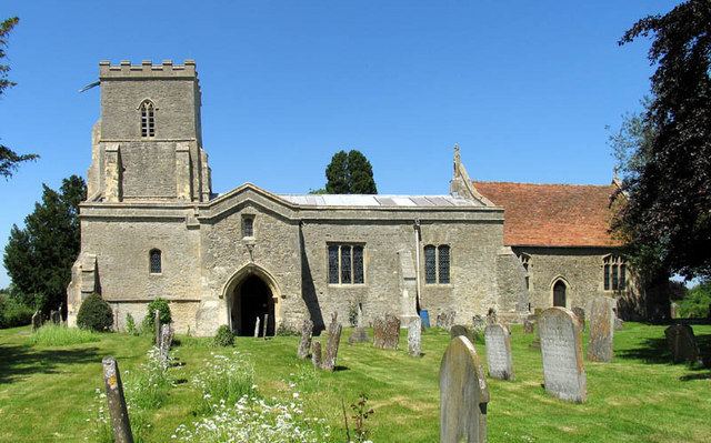
Henry II granted land in the parish to the priory of Santingfeld in Picardy, France. It is possible that a hospital was founded on this land, although it is uncertain. In the reign of Henry VI, when all alien church possessions were seized by the Crown, this land was given to King's College, Cambridge.
The theologian John Wyclif was vicar of Ludgershall 1368–74.
Ludgershall Bike Night
The village plays host to an annual charity motorbike night, typically on the first Monday in July. The free to attend meet sees riders of vintage, classic and contemporary motorcycles gather on the village green. The event is attended by multiple motorcycle clubs and enthusiasts alike.