
Elevation 426 m Local time Wednesday 12:17 PM | Postal code 379 01 Area 12.14 km² | |
 | ||
Weather 9°C, Wind W at 11 km/h, 68% Humidity | ||
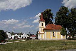
Lužnice is a village and municipality (obec) in Jindřichův Hradec District in the South Bohemian Region of the Czech Republic.
Map of 379 01 Lu%C5%BEnice, Czechia
The municipality covers an area of 12.14 square kilometres (4.69 sq mi), and has a population of 397 (as at 28 August 2006).
Lužnice lies approximately 20 kilometres (12 mi) south-west of Jindřichův Hradec, 24 km (15 mi) north-east of České Budějovice, and 116 km (72 mi) south of Prague.
References
Lužnice (Jindřichův Hradec District) Wikipedia(Text) CC BY-SA