
Population 333 (2011) Lower Tenthill Woodlands | Postcode(s) 4343 Postal code 4343 | |
 | ||
Lower Tenthill is a locality in the Lockyer Valley Region of South East Queensland, Australia. At the 2011 Australian Census the locality recorded a population of 333.
Map of Lower Tenthill QLD 4343, Australia
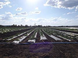
Agriculture has developed along Tenthill Creek which also forms part of both the western and eastern boundary of Lower Tenthill. Lower Tenthill Weir on Tenthill Creek, has a storage capacity of 70 ML and is used for the purpose of recharging groundwater supplies. The northern boundary follows Lockyer Creek. Two other creeks cross the area - Ma Ma Creek and Deep Creek.
Tent Hill Lower State School opened in 1873.
References
Lower Tenthill, Queensland Wikipedia(Text) CC BY-SA