
Length 2.4 mi (3.9 km) Trail difficulty Easy | Use Hiking, bicycling Season Year-round | |
 | ||
Location Dorchester, Massachusetts to Milton, Massachusetts Trailheads Port Norfolk, Dorchester;Central Avenue, Milton() | ||
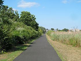
The Lower Neponset River Trail is a 2.4-mile-long (3.9 km) rail trail running along the Neponset River in the Dorchester section of Boston, Massachusetts. It roughly follows the path of the eastern part of the Dorchester and Milton Branch Railroad from the Port Norfolk neighborhood in Dorchester to the Central Avenue T Station in Milton, passing through Pope John Paul II Park, the Neponset Marshes, and the Lower Mills area.
Map of Neponset Trail, Boston, MA, USA
References
Lower Neponset River Trail Wikipedia(Text) CC BY-SA