
- land 0.95 sq mi (2 km) Area 163 ha | - summer (DST) CDT (UTC-5) Area code 504 | |
 | ||
- water 0.21 sq mi (1 km), 18.1% Restaurants Cochon, Pêche Seafood Grill, La Boca, Emeril's, Juan's Flying Burrito Hotels Hampton Inn & Suites Ne, New Orleans Downtow, Hilton Garden Inn New Orle, Hyatt Place New Orleans, Henry Howard Hotel | ||
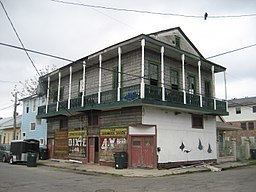
Lower Garden District is a neighborhood of the city of New Orleans. A subdistrict of the Central City/Garden District Area, its boundaries as defined by the City Planning Commission are: St. Charles Avenue, Felicity, Prytania, Thalia, Magazine, and Julia Streets to the north; the New Orleans Morial Convention Center, Crescent City Connection, and Mississippi River to the east; Felicity Street, Magazine Street, Constance Street, Jackson Avenue, Chippewa Street, Soraparu Street, and St. Thomas Street to the south; and 1st Street to the west.
Contents
- Map of Lower Garden District New Orleans LA 70130 USA
- Geography
- Adjacent neighborhoods
- Boundaries
- Demographics
- Education
- Notable residents
- References
Map of Lower Garden District, New Orleans, LA 70130, USA
Geography
Lower Garden District is located at 29°56′02″N 90°04′12″W and has an elevation of 6 feet (1.8 m). According to the United States Census Bureau, the district has a total area of 1.16 square miles (3.0 km2), 0.95 square miles (2.5 km2) of which is land and 0.21 square miles (0.5 km2) (18.1%) of which is water.
It includes the Papillon Apartments, an apartment complex operated by Tulane University for graduate students and their families.
Adjacent neighborhoods
Boundaries
The City Planning Commission defines the various boundaries of the Lower Garden District with these streets: St. Charles Avenue, Prytania Street, Felicity Street, Thalia Street, Magazine Street, Julia Street, the New Orleans Morial Convention Center, Crescent City Connection, Mississippi River, Constance Street, Jackson Avenue, Chippewa Street, Soraparu Street, St. Thomas Street, and First Street.
Demographics
As of the census of 2000, there were 6,116 people, 3,332 households, and 998 families residing in the neighborhood. The population density was 6,438 /mi² (2,446 /km²).
As of the census of 2010, there were 6,363 people, 3,843 households, and 994 families residing in the neighborhood.
Education
The Garden District is zoned to schools in the New Orleans Public Schools and the Recovery School District.
ReNEW SciTech Academy, operated by ReNEW Schools, is within the former Laurel Elementary School within the Lower Garden District. After Hurricane Katrina, Laurel was a school directly operated by the RSD. In 2010 Laurel had a performance score of 45, below the "65" score that was considered "academically unacceptable."
The International School of Louisiana (New Orleans International School), one of the two schools in New Orleans that is chartered by the State of Louisiana but is not a part of the RSD, operates the Camp Street Campus, located in the former Andrew Jackson Elementary School in the lower Garden District. This campus opened in 2000. The Center for Education Reform in 2007 ranked the International School as one of the best charters in the United States.