
Country United States ZIP code 97419 Local time Monday 9:20 PM | Time zone Pacific (PST) (UTC-8) Area code(s) 458 and 541 | |
 | ||
Weather 13°C, Wind SW at 6 km/h, 97% Humidity | ||
Low Pass is an unincorporated community in Lane County, Oregon, United States, on the Long Tom River, 5 miles (8 km) east of Blachly and 11 miles (18 km) west of Cheshire.
Map of Low Pass, OR 97419, USA
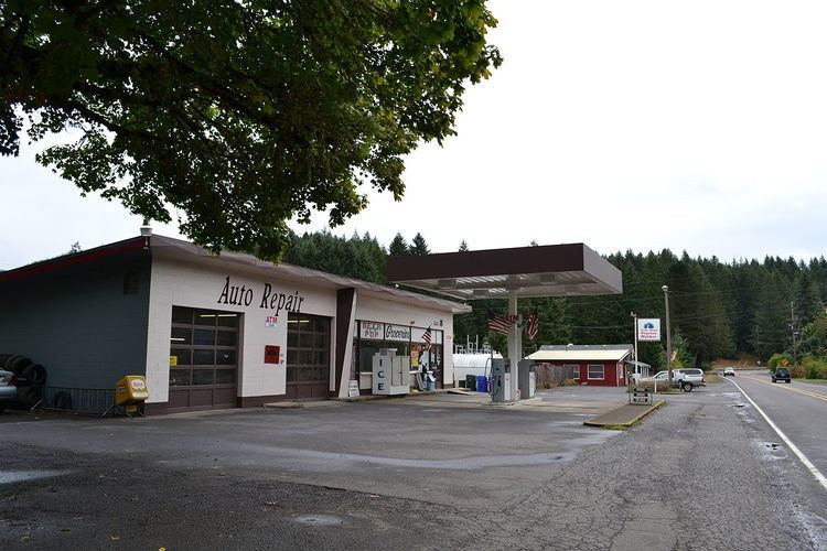
The settlement is centered on a small pullout on Oregon Route 36 with a gas station/convenience store and a diner that serves as an unofficial community center for rural residents.
The nearest recycling & waste facility is the Low Pass Transfer Station
The settlement is named for its location on a slight rise approaching the foothills of the Coast Range mountains, in contrast to the nearby mountain pass High Pass. Much of the land west of Low Pass consists of old-growth forest owned by the Bureau of Land Management.
The community has also been known as "Long Tom Station" after the nearby river; the name Low Pass was made official by a United States Board on Geographic Names decision of 1985.