
Country United States FIPS code 19-47010 Elevation 198 m Zip code 52757 Local time Monday 11:15 PM | Time zone Central (CST) (UTC-6) GNIS feature ID 0458650 Area 122 ha Population 284 (2013) Area code 563 | |
 | ||
Weather -5°C, Wind N at 27 km/h, 92% Humidity | ||
How to say or pronounce usa cities low moor iowa
Low Moor is a city in Clinton County, Iowa, United States. The population was 288 at the 2010 census.
Contents
- How to say or pronounce usa cities low moor iowa
- Map of Low Moor IA USA
- History
- Geography
- 2010 census
- 2000 census
- References
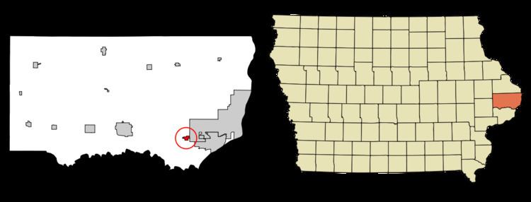
Map of Low Moor, IA, USA
History
Low Moor was platted in 1858, at the time the Chicago and North Western Railway was built. The name Low Moor was selected after someone noticed that Low Moor, England, was stamped on the iron rails.
Geography
Low Moor is located at 41°48′5″N 90°21′22″W (41.801348, -90.356218).
According to the United States Census Bureau, the city has a total area of 0.47 square miles (1.22 km2), all of it land.
2010 census
As of the census of 2010, there were 288 people, 117 households, and 77 families residing in the city. The population density was 612.8 inhabitants per square mile (236.6/km2). There were 124 housing units at an average density of 263.8 per square mile (101.9/km2). The racial makeup of the city was 97.6% White, 0.7% African American, and 1.7% from two or more races. Hispanic or Latino of any race were 0.3% of the population.
There were 117 households of which 26.5% had children under the age of 18 living with them, 49.6% were married couples living together, 6.0% had a female householder with no husband present, 10.3% had a male householder with no wife present, and 34.2% were non-families. 23.1% of all households were made up of individuals and 10.2% had someone living alone who was 65 years of age or older. The average household size was 2.46 and the average family size was 2.75.
The median age in the city was 39.6 years. 21.9% of residents were under the age of 18; 9.8% were between the ages of 18 and 24; 22.7% were from 25 to 44; 29.5% were from 45 to 64; and 16.3% were 65 years of age or older. The gender makeup of the city was 53.5% male and 46.5% female.
2000 census
As of the census of 2000, there were 240 people, 94 households, and 68 families residing in the city. The population density was 514.6 people per square mile (197.2/km²). There were 100 housing units at an average density of 214.4 per square mile (82.1/km²). The racial makeup of the city was 99.58% White and 0.42% Native American.
There were 94 households out of which 30.9% had children under the age of 18 living with them, 61.7% were married couples living together, 5.3% had a female householder with no husband present, and 26.6% were non-families. 23.4% of all households were made up of individuals and 6.4% had someone living alone who was 65 years of age or older. The average household size was 2.55 and the average family size was 3.00.
25.0% are under the age of 18, 8.3% from 18 to 24, 32.5% from 25 to 44, 20.8% from 45 to 64, and 13.3% who were 65 years of age or older. The median age was 38 years. For every 100 females there were 105.1 males. For every 100 females age 18 and over, there were 106.9 males.
The median income for a household in the city was $40,417, and the median income for a family was $44,500. Males had a median income of $31,875 versus $17,188 for females. The per capita income for the city was $18,585. About 2.6% of families and 5.5% of the population were below the poverty line, including 8.5% of those under the age of eighteen and none of those sixty five or over.