
Time zone CET (UTC+1) | Region Occitanie Population (1999) 42 Area 5.39 km² | |
 | ||
Arrondissement | ||
Loudervielle is a commune in the Hautes-Pyrénées department in south-western France.
Map of 65240 Loudervielle, France
Loudervielle sits in the Bigorre region, in the valley of the river Louron. The west side of the mountain pass Col de Peyresourde lies on the eastern edge of the commune.
The village's original Latin name, found in the church register of Comminges, was De Lodirvilla, and the name in Occitan is Lodervièla.
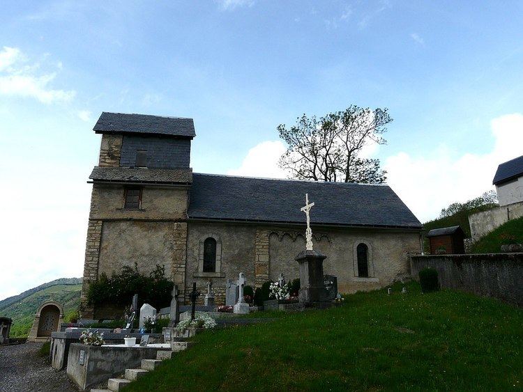
The village is home to the church of Sainte-Marie-Madeleine and the 12th-century Tour de Moulor, the ruins of a medieval castle.
The village arms are described as Azure, a lion or, a chief argent with three crescents of the field, the largest in the middle.
References
Loudervielle Wikipedia(Text) CC BY-SA