
Country United States GNIS feature ID 0453582 Area 110.7 km² Population 572 (2010) | ZIP codes 47432, 47527, 47581 Elevation 174 m Local time Monday 6:38 AM | |
 | ||
Weather -1°C, Wind E at 13 km/h, 52% Humidity | ||
Lost River Township is one of six townships in Martin County, Indiana, United States. As of the 2010 census, its population was 572 and it contained 265 housing units.
Contents
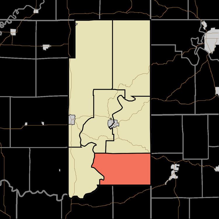
- Map of Lost River Township IN USA
- Geography
- Unincorporated towns
- Cemeteries
- Major highways
- School districts
- Political districts
- References
Map of Lost River Township, IN, USA
Geography
According to the 2010 census, the township has a total area of 42.75 square miles (110.7 km2), of which 42.29 square miles (109.5 km2) (or 98.92%) is land and 0.46 square miles (1.2 km2) (or 1.08%) is water.
Unincorporated towns
(This list is based on USGS data and may include former settlements.)
Cemeteries
The township contains these seven cemeteries: Anderson, Cornel, Emmons Ridge, Green, Jones, Simmons and Walker.
Major highways
School districts
Political districts
References
Lost River Township, Martin County, Indiana Wikipedia(Text) CC BY-SA