
Local time Monday 4:36 PM | ||
 | ||
Municipal district Chukotsky Municipal District Rural settlement Lorino Rural Settlement Administrative center of Lorino Rural Settlement Weather -11°C, Wind NW at 10 km/h, 73% Humidity | ||
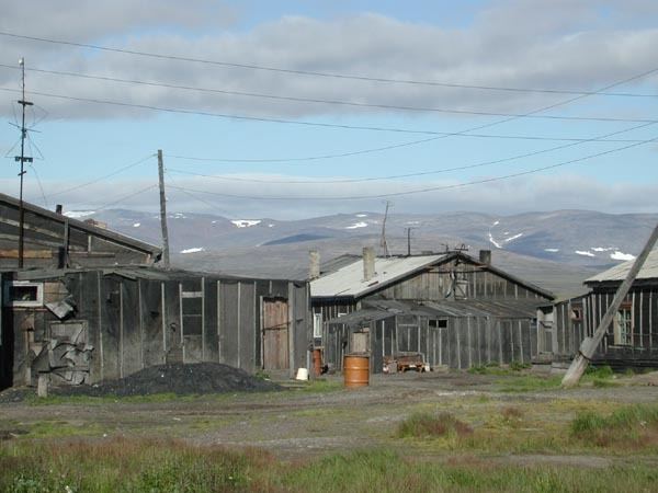
Lorino (Russian: Лорино; Chukchi: Льурэн, lit. found camp) is a rural locality (a selo) in Chukotsky District of Chukotka Autonomous Okrug, Russia. It is located on the boundary of the Chukchi Sea and the Bering Sea. Population: 1,267 (2010 Census); Municipally, Lorino is subordinated to Chukotsky Municipal District and incorporated as Lorino Rural Settlement.
Contents
- Map of Lorino Chukotka Autonomous Okrug Russia 689315
- Geography
- History
- Culture
- Demographics
- Transport
- Climate
- References
Map of Lorino, Chukotka Autonomous Okrug, Russia, 689315
Geography
Lorino is the largest indigenous village in the whole autonomous okrug and larger even than Lavrentiya, the administrative centre of the district, which is found to the north-west of Lorino. The village is located on the shores of the Bering Sea, on the Mechigmen spit. it is 40.5 km to the district centre. In the vicinity of the village located Lorinski (Kukunyskie) hot springs.
History
The name "Lorino" comes from the Chukchi "льурэн" (lyuren), meaning "found camp". The first mention of Lorino comes from the 18th century, with the modern Chukchi village located on the site of the former Eskimo settlement of Nukak [6]. The main occupation of the inhabitants is sea mammal hunting, reindeer herding and fishing and the village is the base for the municipal agricultural enterprise "Keper" (Russian: Кэпэр). A fox farm was established in the village in 1955 and a processing factory for seafood and meat canning was opened in 2009.
Culture
The area around the village was used as the setting for the film The Chief of Chukotka. The Lorino hot springs are located 15 kilometers (9.3 mi) from the village.
The village has a high school, a daycare center, a boarding school, a cultural center, a food store, a hospital, a post-office, and a breeding farm with more than 300 Arctic foxes. The Lorino Dawns native ensemble under the guidance of N. Ginuntegin is based in the village.
Demographics
The population as of the official 2010 census results was 1267, of whom 628 were male and 639 female. this is a reduction on a 2003 estimate by Red Cross Chukotka as 1,419, of which 1,288 were indigenous peoples.
Transport
The village of Lorino is linked to Lavrentiya by a 40 kilometers (25 mi) unpaved road. Other than this short road, Lavrentiya, despite being the administrative centre of the district is not linked to any other part of the world by road. There is however, a small number of roads within the settlement including:
Climate
Lorino has a Tundra climate (ET) because the warmest month has an average temperature between 0 °C (32 °F) and 10 °C (50 °F).