
Primary outflows Cascade Brook Max. length 0.2 mi (0.32 km) Surface area 12.2 acres (49,000 m) Max depth 2.44 m Mean depth 1.2 m Width 200 m | Basin countries United States Max. width 0.1 mi (0.16 km) Surface elevation 832 m Area 5 ha Length 322 m | |
 | ||
Similar Kinsman Mountain, Franconia Notch State Park, Cannon Mountain, Franconia Range, High Huts of the White Mo | ||
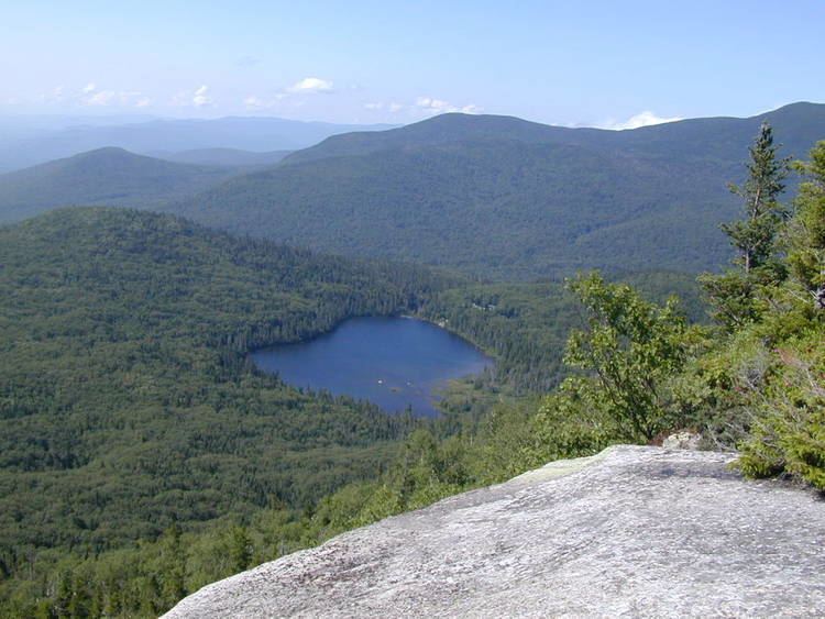
Lonesome Lake is a 12.2-acre (49,000 m2) water body located in Franconia Notch in the White Mountains of New Hampshire, south of Cannon Mountain. The lake is reachable by hiking trails from the Franconia Notch Parkway and features an Appalachian Mountain Club hut on its southwest shore.
Map of Lonesome Lake, Lincoln, NH 03580, USA
The lake lies in the Merrimack River watershed. Its outlet, Cascade Brook, flows south over ledges and waterfalls to the Pemigewasset River near "The Basin" in Franconia Notch. The Pemigewasset in turn flows south to the Merrimack River, which reaches the Atlantic Ocean at Newburyport, Massachusetts.
Lonesome Lake is part of Franconia Notch State Park. The Appalachian Trail passes the lake at its outlet. Additional hiking trails travel north to Cannon Mountain.
The lake is classified as a coldwater fishery and contains brook trout.