
Nickname Lomničák Elevation 2,634 m First ascent 1760 | Easiest route cable car Prominence 434 m | |
 | ||
Similar Gerlachovský štít, High Tatras, Kriváň, Slavkovský štít, Rysy | ||
Skiing lomnicky peak lomnick t t in high tatras slovakia
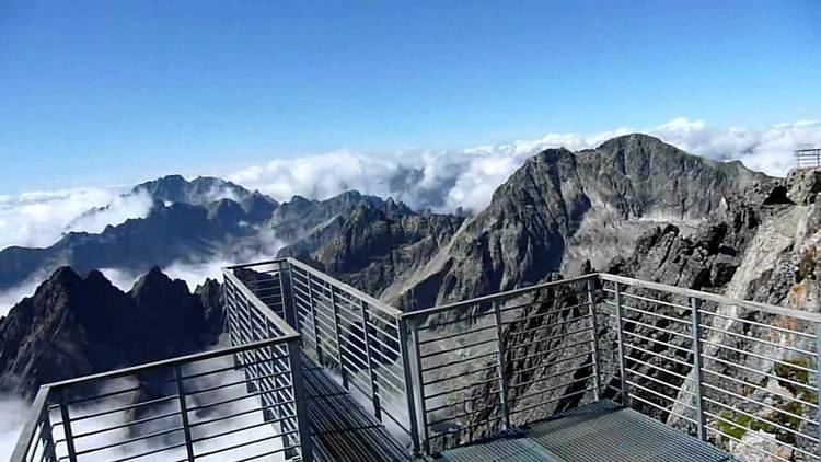
Lomnický štít (Lomnický peak) is one of the highest and most visited mountain peaks in the High Tatras mountains of Slovakia. Connected by cable car [1] to Tatranská Lomnica, its summit is 2634 metres above sea level, making it the second highest peak in the High Tatras after Gerlachovský štít (2654 m).
Contents
- Skiing lomnicky peak lomnick t t in high tatras slovakia
- Map of LomnickC3BD C5A1tC3ADt 059 60 VysokC3A9 Tatry Slovakia
- T emi lanovkami z tatransk lomnice na lomnick t t 3 7 2015
- References
Map of Lomnick%C3%BD %C5%A1t%C3%ADt, 059 60 Vysok%C3%A9 Tatry, Slovakia
The first ascent was made by local shoemaker and amateur miner Štefan Fábry around 1760-1790, but the first recorded ascent was made by the English traveler Robert Townson and guide on 16 August 1793. He measured almost precisely the elevation of the peak at 2633 m. The first winter ascent was made in 1891.
In the past, Lomnický štít was called Dedo ("Grandpa"). Before the 19th century, the peak was also thought to be the highest of all.
Since 1940, tourists have reached the peak by cable car, which was the most modern in Europe at the time of opening. They are allowed to stay on the peak for 50 minutes. The cable car system is normally closed in the month of May for annual maintenance. It is also possible to climb the peak from Lomnický Saddle, but this is only permitted with a mountain guide.
There is a solar observatory and weather station permanently manned year round at the terminus of the cable car.