
Max. width 0.3 mi (0.48 km) Surface elevation 221 m Shore length 5.7 km | Max. length 0.66 mi (1.06 km) Surface area 35.9 ha (89 acres) Area 36 ha | |
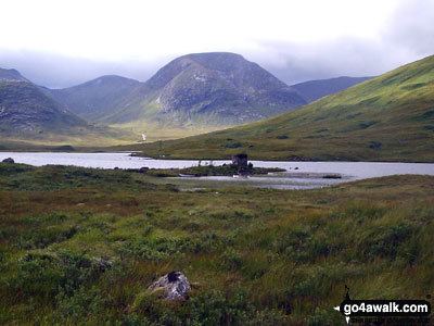 | ||
Loch Dochard is an upland freshwater loch lying approximately 6 km (3.7 mi) west of Bridge of Orchy in Strathclyde, Scottish Highlands. The loch has an irregular shape with a perimeter of 3 km (1.9 mi). It is approximately 0.66 mi (1.06 km) long, has an average depth of 12 ft (3.7 m) and is 42 ft (13 m) at its deepest. The loch was surveyed on 18 May 1903 by Sir John Murray and later charted as part of his Bathymetrical Survey of Fresh-Water Lochs of Scotland 1897-1909.
Map of Loch Dochard, Bridge of Orchy, UK
References
Loch Dochard Wikipedia(Text) CC BY-SA