
Population 673 (2011) Community Llangelynin Sovereign state United Kingdom Local time Thursday 11:23 AM | OS grid reference SH570071 Country Wales Postcode district LL36 Dialling code 01654 | |
 | ||
Weather 11°C, Wind NE at 24 km/h, 67% Humidity | ||
Llangelynnin (or Llangelynin) is a small village and community near Tywyn, Gwynedd, Wales. Although the village is usually known as Llangelynnin in English, the community name used is Llangelynin.
Contents
Map of Llangelynin, Tywyn, UK
Location, History & Amenities
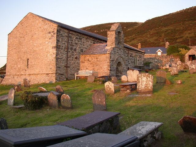
Llangelynnin sits on a slope above Cardigan Bay to the north of Tywyn. The A493 road and Cambrian Coast railway pass through the village, although the railway station closed in 1991. Llangelynnin's parish church dates from the 13th century and is dedicated to Saint Celynnin.
The poet and scholar John Morgan was born in the village and Abram Wood, a famous Welsh gypsy, was buried there in 1799.
The community of Llangelynnin includes the larger village of Llwyngwril and the hamlet of Rhoslefain within its boundaries. It has an area of 2,154 hectares and a population of 708 (2001 census), reducing to 673 at the 2011 census.
Governance
An electoral ward in the same name exists. This ward includes the community of Arthog with a total population at the 2011 census of 2,008.