
Mountain type Andesitic remnant Easiest route Rock & Ice climb First ascent 1894 Mountain range Cascade Range | Elevation 3,395 m Prominence 249 m Parent range Cascade Range | |
 | ||
Topo map USGS Mount Rainier East Age of rock Less than 500,000 years Similar Goode Mountain, Bonanza Peak, Buckner Mountain, Mount Rainier, Seven Fingered Jack | ||
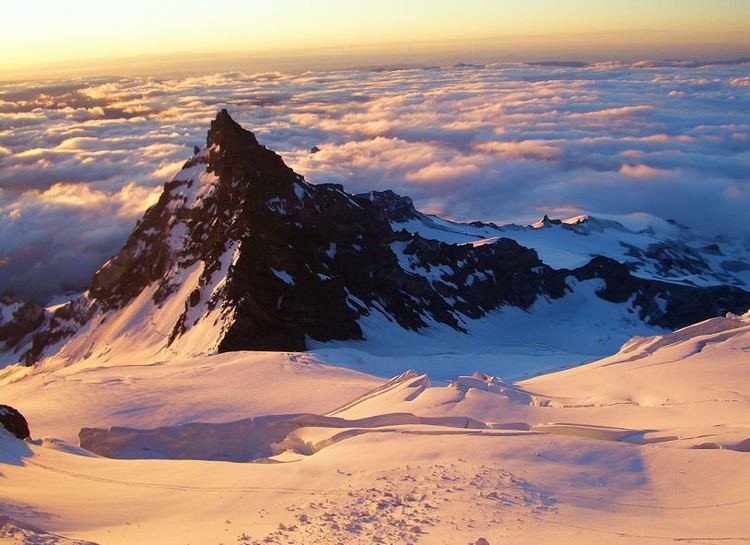
Little Tahoma Peak, also called Little Tahoma, is a satellite peak of Mount Rainier in Pierce County, Washington and in Mount Rainier National Park. It is quite noticeable from Seattle over 60 miles (97 km) away.
Map of Little Tahoma Peak, Washington 98304, USA
Little Tahoma Peak is a volcanic remnant. It was part of a larger Mount Rainier which has eroded. The rock is quite unstable and in 1963 a large avalanche originating below it covered the lower section of Emmons Glacier with rock debris. The Fryingpan Glacier and Whitman Glacier are located just to the east of the peak.
Little Tahoma Peak can most easily be accessed from Summerland, an alpine meadow area in Mount Rainier National Park. The first recorded ascent was on August 29, 1894 by JB Flett and Henry H. Garrison who climbed from Summerland using the east shoulder.
If considered on its own, Little Tahoma would be the third-highest peak in Washington.