
- elevation 6,100 ft (1,859 m) Length 79 km Basin area 2,494 km² Mouth Little Lost River Sinks | - elevation 4,806 ft (1,465 m) Discharge 1.815 m³/s Basin area 2,494 km² | |
 | ||
- left Sawmill Creek, Uncle Ike Creek - right Summit Creek, Wet Creek - location Near Howe, Butte County | ||
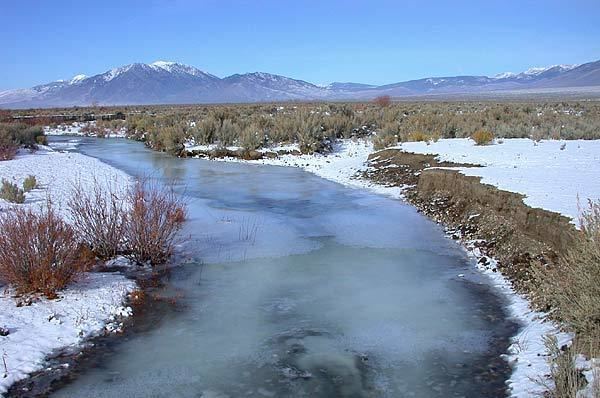
The Little Lost River is a river in the central part of the U.S. state of Idaho. The river is about 49 miles (79 km) long and drains an arid farming valley, the Little Lost River Valley, bordered by the Lost River Range on the west and Lemhi Range on the east. Instead of emptying into a larger body of water, it disappears into the ground at the edge of the Snake River Plain, a phenomenon that gives it its name. The water feeds into the Snake River Aquifer, eventually reaching the Snake River through a series of springs farther west.
Map of Little Lost River, Idaho, USA
It rises at the confluence of two similarly sized streams, Summit Creek and Sawmill Creek, 10 miles (16 km) north of Hawley Mountain, in the middle of the Little Lost River Valley. The river flows generally south-southeast receiving many tributaries such as Wet (the largest), Badger, Deer, Uncle Ike, Sands, Cedarville, South, and Hurst creeks. Along its course the Little Lost is used for irrigation, but the only settlement of any size is Howe, situated near the mouth. A few miles past Howe, the river disappears into the earth at about 4,806 feet (1,465 m) above sea level.
The river drains about 963 square miles (2,490 km2) of land entirely in Butte County. Its valley is about 50 miles (80 km) long and 20 miles (32 km) wide, with a floor width of 7 miles (11 km). Precipitation is generally very low and mostly in the form of snow.