
Population 40 (2001) Local time Friday 9:50 AM District St Edmundsbury | Sovereign state United Kingdom Postcode district IP31 Dialling code 01284 | |
 | ||
Weather 9°C, Wind E at 24 km/h, 77% Humidity | ||
Little Livermere is a village in England situated about 5 miles (8 km) north of Bury St Edmunds, in an area of Suffolk known as the Breckland. The population at the 2011 Census is included in the civil parish of Ampton
Map of Little Livermere, Bury Saint Edmunds, UK
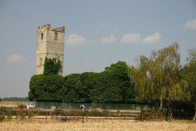
The village was almost entirely demolished in the 18th century when a park and mere were created in the grounds of the stately home, which was itself destroyed in the 1920s. All that remains of the village is the much decayed Church of St Peter and St Paul, which is roofless and considered unsafe, and a farmhouse that stands adjacent to the church.
References
Little Livermere Wikipedia(Text) CC BY-SA