There are at least 993 named trails in Montana according to the U.S. Geological Survey, Board of Geographic Names. A trail is defined as: "Route for passage from one point to another; does not include roads or highways (jeep trail, path, ski trail)."
List of trails of Beaverhead County, Montana
Big Horn County, Montana
Soldier Trail, 45°14′00″N 107°56′43″W, el. 4,455 feet (1,358 m)
Three Springs Trail, 45°11′23″N 107°54′23″W, el. 5,469 feet (1,667 m)
Blaine County, Montana
Cow Island Trail, 47°57′47″N 109°09′44″W, el. 3,402 feet (1,037 m)
Broadwater County, Montana
Divide Trail, 46°28′08″N 111°15′07″W, el. 8,576 feet (2,614 m)
Flathead Indian Trail, 46°17′25″N 111°12′18″W, el. 6,457 feet (1,968 m)
List of trails of Carbon County, Montana
Chouteau County, Montana
Hole in the Wall Trail, 47°48′51″N 110°03′24″W, el. 2,644 feet (806 m)
Clearwater County, Idaho
Lolo Trail, 46°38′10″N 114°36′26″W, el. 6,424 feet (1,958 m)
State Line Trail, 46°43′55″N 114°38′59″W, el. 7,087 feet (2,160 m)
Dawson County, Montana
Cap Rock Nature Trail, 47°03′08″N 104°40′48″W, el. 2,615 feet (797 m)
Deer Lodge County, Montana
Long Canyon Trail, 46°02′11″N 112°53′59″W, el. 6,201 feet (1,890 m)
Fergus County, Montana
Crystal Lake National Recreation Trail, 46°47′48″N 109°31′11″W, el. 6,227 feet (1,898 m)
Old Musselshell Trail, 47°30′19″N 108°23′42″W, el. 2,887 feet (880 m)
Skyline Trail, 47°32′11″N 108°21′40″W, el. 2,743 feet (836 m)
Wagon Wheel Trail, 47°41′45″N 109°42′02″W, el. 3,094 feet (943 m)
Wilder Trail, 47°34′21″N 108°26′38″W, el. 2,887 feet (880 m)
List of trails of Flathead County, Montana
List of trails of Gallatin County, Montana
List of trails of Glacier County, Montana
List of trails of Granite County, Montana
Hill County, Montana
Mogul Alley Ski Trail, 48°10′40″N 109°38′03″W, el. 4,767 feet (1,453 m)
North Bowl Ski Trail, 48°10′40″N 109°38′03″W, el. 4,767 feet (1,453 m)
Screaming Eagle Ski Trail, 48°10′40″N 109°38′03″W, el. 4,767 feet (1,453 m)
Teacup Ski Trail, 48°10′40″N 109°38′03″W, el. 4,767 feet (1,453 m)
The Face Ski Trail, 48°10′40″N 109°38′03″W, el. 4,767 feet (1,453 m)
Towering Heights Ski Trail, 48°10′40″N 109°38′03″W, el. 4,767 feet (1,453 m)
Jefferson County, Montana
Fetters Trail, 46°04′28″N 112°00′29″W, el. 6,719 feet (2,048 m)
Upper Whitetail Park Trail, 46°02′11″N 112°13′43″W, el. 6,434 feet (1,961 m)
Lake County, Montana
Crow Creek Trail, 47°34′51″N 113°57′56″W, el. 4,800 feet (1,500 m)
Crow Creek Trail, 47°38′05″N 113°50′15″W, el. 3,917 feet (1,194 m)
Peterson Creek Trail, 48°02′31″N 113°53′15″W, el. 5,873 feet (1,790 m)
Wire Trail, 47°54′34″N 113°46′28″W, el. 5,807 feet (1,770 m)
Lemhi County, Idaho
Divide Trail, 45°34′55″N 114°07′00″W, el. 7,677 feet (2,340 m)
List of trails of Lewis and Clark County, Montana
List of trails of Lincoln County, Montana
List of trails of Madison County, Montana
List of trails of Meagher County, Montana
Mineral County, Montana
Cedar Creek Stock Driveway, 47°08′41″N 115°02′45″W, el. 5,741 feet (1,750 m)
Oriole Creek Trail, 46°47′15″N 114°37′14″W, el. 5,423 feet (1,653 m)
Storm Peak Trail, 47°23′13″N 115°28′20″W, el. 5,098 feet (1,554 m)
Trout Creek Stock Driveway, 47°06′29″N 114°57′25″W, el. 6,457 feet (1,968 m)
List of trails of Missoula County, Montana
List of trails of Park County, Montana
Petroleum County, Montana
Horse Camp Trail, 47°30′23″N 108°18′16″W, el. 2,844 feet (867 m)
Pondera County, Montana
North Badger-Elbow Creek Trail, 48°11′16″N 113°09′17″W, el. 5,909 feet (1,801 m)
List of trails of Powell County, Montana
Prairie County, Montana
Calypso Trail, 46°47′38″N 105°28′07″W, el. 2,434 feet (742 m)
List of trails of Ravalli County, Montana
Richland County, Montana
Lewis and Clark National Historic Trail, 48°07′35″N 104°51′17″W, el. 1,916 feet (584 m)
List of trails of Sanders County, Montana
Sweet Grass County, Montana
Black Butte Trail, 45°37′51″N 109°51′54″W, el. 5,643 feet (1,720 m)
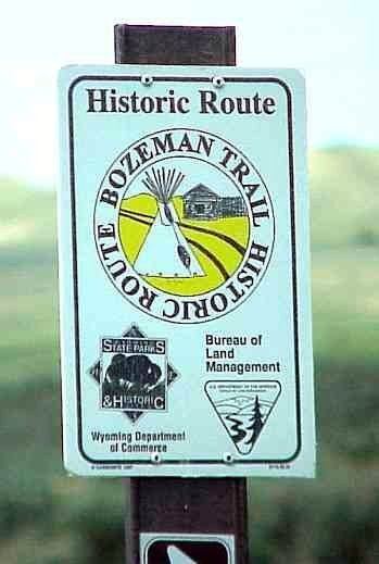
Bozeman Trail, 45°39′30″N 109°42′43″W, el. 4,764 feet (1,452 m)
Lodgepole Trail, 45°33′01″N 109°57′58″W, el. 7,195 feet (2,193 m)
Teton County, Montana
Jones Creek National Recreation Trail, 47°56′56″N 112°44′37″W, el. 5,833 feet (1,778 m)
Mortimer Gulch National Recreation Trail, 47°38′21″N 112°46′28″W, el. 5,712 feet (1,741 m)
South Fork Teton-Blacktail National Recreation Trail, 47°43′46″N 112°45′21″W, el. 6,165 feet (1,879 m)
West Fork Jones Creek National Recreation Trail, 47°56′33″N 112°45′32″W, el. 6,092 feet (1,857 m)
Toole County, Montana
Bootlegger Trail, 48°14′11″N 111°19′09″W, el. 3,212 feet (979 m)
Yellowstone County, Montana
Bill Bartley Trail, 45°43′56″N 108°49′50″W, el. 3,970 feet (1,210 m)
John Dunn Trail, 45°44′16″N 108°49′07″W, el. 3,674 feet (1,120 m)