
 | ||
The following sortable table comprises the 200 most topographically isolated mountain peaks of the United States of America (excluding its territories) with at least 500 meters (1640 feet) of topographic prominence.
The summit of a mountain or hill may be measured in three principal ways:
- The topographic elevation of a summit measures the height of the summit above a geodetic sea level.
- The topographic prominence of a summit is a measure of how high the summit rises above its surroundings.
- The topographic isolation (or radius of dominance) of a summit measures how far the summit lies from its nearest point of equal elevation.
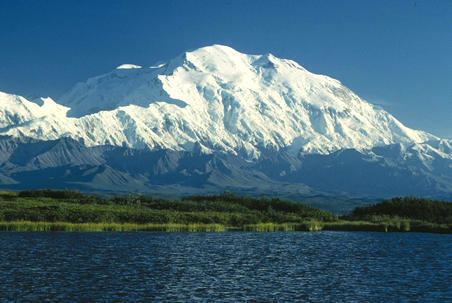
In the United States, only Denali exceeds 4000 kilometers (2485 miles) of topographic isolation. Three summits exceed 2000 kilometers (1243 miles), seven exceed 1000 kilometers (621.4 miles), 12 exceed 500 kilometers (310.7 miles), 44 exceed 200 kilometers (124.3 miles), 107 exceed 100 kilometers (62.14 miles), and 205 major summits exceed 50 kilometers (31.07 miles) of topographic isolation.
Most isolated major summits
Of these 200 most isolated major summits of the United States, 63 are located in Alaska, 19 in Montana, 16 in California, 14 in Utah, 13 in Nevada, 12 in Colorado, 12 in Arizona, ten in Wyoming, seven in Washington, seven in Oregon, six in New Mexico, four in Hawaiʻi, three in Idaho, three in Texas, two in North Carolina, two in Maine, two in New York, and one each in New Hampshire, Arkansas, South Dakota, Tennessee, Vermont, and Virginia. Two of these summits lie on the international border between Alaska and British Columbia and one lies on the state border between Tennessee and North Carolina.