
Population 208 (2011) Sovereign state United Kingdom Local time Saturday 5:50 AM District Babergh | OS grid reference TL977449 Post town Ipswich | |
 | ||
Weather 12°C, Wind W at 29 km/h, 81% Humidity | ||
Lindsey is a small village and a civil parish, located in mid-to-south Suffolk, under the purview of Babergh District Council.
Contents
Map of Lindsey, UK
Layout
The parish contains the villages and hamlets of Lindsey, Lindsey Tye (grid reference TL982459) and Rose Green and collectively they contain about 92 households, albeit over a wide area.
Rose Green contains four listed buildings: Chapel of St James, Rose Green Farmhouse, White Rose Inn, and an unnamed cottage.
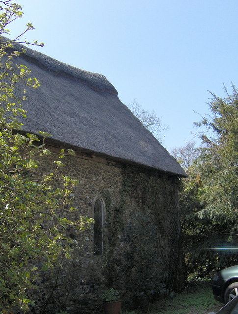
Sights in the area include St James's Chapel, a 13th-century thatched chapel under the protection of English Heritage.
References
Lindsey, Suffolk Wikipedia(Text) CC BY-SA