
Country United States FIPS code 36-42576 Elevation 373 m Population 1,913 (2000) Area code 607 | State New York Time zone Eastern (EST) (UTC-5) GNIS feature ID 0979153 Zip code 14858 Local time Saturday 1:16 AM | |
 | ||
Weather -3°C, Wind S at 6 km/h, 64% Humidity Area 98.16 km² (97.12 km² Land / 78 ha Water) | ||
Lindley is a town in southern Steuben County, New York, United States. The population was 1,913 at the 2000 census. The town was named after the early settler Eleazer Lindsley.
Contents
- Map of Lindley NY 14858 USA
- History
- Geography
- Demographics
- Communities and other locations in the Town of Lindley
- References
Map of Lindley, NY 14858, USA
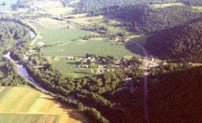
The town is situated south of the city of Corning.
History
The town was formed in 1837 from the town of Erwin.
Geography
According to the United States Census Bureau, the town has a total area of 37.9 square miles (98 km2), of which, 37.5 square miles (97 km2) of it is land and 0.3 square miles (0.78 km2) of it (0.90%) is water.
The south town line is the border of Tioga County, Pennsylvania. U.S. Route 15 and the Tioga River pass in a north-south direction through the town.
Demographics
As of the census of 2000, there were 1,913 people, 697 households, and 545 families residing in the town. The population density was 50.9 people per square mile (19.7/km²). There were 763 housing units at an average density of 20.3 per square mile (7.8/km²). The racial makeup of the town was 98.22% White, 0.31% African American, 0.21% Native American, 0.16% Asian, 0.16% from other races, and 0.94% from two or more races. Hispanic or Latino of any race were 0.68% of the population.
There were 697 households out of which 35.9% had children under the age of 18 living with them, 63.3% were married couples living together, 9.8% had a female householder with no husband present, and 21.7% were non-families. 17.2% of all households were made up of individuals and 6.5% had someone living alone who was 65 years of age or older. The average household size was 2.74 and the average family size was 3.02.
In the town, the population was spread out with 27.6% under the age of 18, 9.0% from 18 to 24, 27.8% from 25 to 44, 26.0% from 45 to 64, and 9.6% who were 65 years of age or older. The median age was 35 years. For every 100 females there were 102.9 males. For every 100 females age 18 and over, there were 101.6 males.
The median income for a household in the town was $37,443, and the median income for a family was $41,250. Males had a median income of $30,037 versus $24,750 for females. The per capita income for the town was $15,625. About 13.5% of families and 15.9% of the population were below the poverty line, including 26.8% of those under age 18 and 5.2% of those age 65 or over.