
Country United States County Allegheny ZIP codes 15133, 15135, 15037 Local time Friday 11:13 PM | State Pennsylvania Time zone Eastern (EST) (UTC-5) Population 1,066 (2013) | |
 | ||
Weather 1°C, Wind E at 6 km/h, 88% Humidity Area 12.95 km² (12.43 km² Land / 52 ha Water) | ||
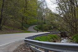
Lincoln is a borough in Allegheny County, Pennsylvania, United States. The population was 1,072 at the 2010 census.
Contents
Map of Lincoln, PA, USA
As of 2009, the mayor is Nick Vay.
Lincoln does not have its own post office. Three ZIP codes are used in the borough: 15133 for the northern portion of the borough adjacent to Liberty and 15135 for the eastern portion, with mail addressed to the city of McKeesport, and 15037 for the remainder of the borough, with mail addressed to Elizabeth.
Lincoln is part of the South Allegheny School District, along with Liberty, Glassport and Port Vue.
Geography
Lincoln is located at 40°17′27″N 79°51′5″W (40.291939, -79.851303). It is bounded by Glassport to the northwest, Liberty to the north, Versailles to the northeast, Elizabeth Township and the Youghiogheny River to the east and south, and Jefferson Hills, Clairton, and the Monongahela River to the west.
According to the United States Census Bureau, the borough has a total area of 5.0 square miles (13 km2), of which 4.8 square miles (12 km2) is land and 0.2 square miles (0.52 km2), or 4.57%, is water.
History
The borough was named for Abraham Lincoln. Lincoln was incorporated on February 6, 1958. Prior to this date, the borough was known as Lincoln Township. The change in governmental structure came after a portion of the borough attempted to secede from Lincoln Township to annex with Liberty Borough.
Demographics
As of the census of 2000, there were 1,218 people, 482 households, and 359 families residing in the borough. The population density was 253.9 people per square mile (98.0/km²). There were 506 housing units at an average density of 105.5 per square mile (40.7/km²). The racial makeup of the borough was 98.77% White, 0.66% African American, 0.08% Native American, 0.33% Asian, and 0.16% from two or more races. Hispanic or Latino of any race were 0.74% of the population.
There were 484 households, out of which 24.8% had children under the age of 18 living with them, 62.4% were married couples living together, 8.9% had a female householder with no husband present, and 25.8% were non-families. 22.1% of all households were made up of individuals, and 9.3% had someone living alone who was 65 years of age or older. The average household size was 2.52 and the average family size was 2.94.
In the borough the population was spread out, with 19.0% under the age of 18, 5.9% from 18 to 24, 27.2% from 25 to 44, 28.1% from 45 to 64, and 19.9% who were 65 years of age or older. The median age was 43 years. For every 100 females there were 92.1 males. For every 100 females age 18 and over, there were 91.3 males.
The median income for a household in the borough was $37,917, and the median income for a family was $43,333. Males had a median income of $35,852 versus $21,131 for females. The per capita income for the borough was $18,447. About 6.9% of families and 9.1% of the population were below the poverty line, including 8.4% of those under age 18 and 14.2% of those age 65 or over.