Admin. region Oberfranken Municipal assoc. Lichtenberg Area 9.47 km² Population 1,107 (31 Dec 2008) Dialling code 09288 | Elevation 564 m (1,850 ft) Postal code 95192 Local time Friday 7:14 AM | |
 | ||
Weather 3°C, Wind SW at 14 km/h, 72% Humidity | ||
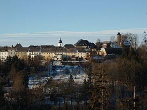
Lichtenberg is a town in northeastern Bavaria, lying in the district of Hof in Upper Franconia.
Contents
Map of 95192 Lichtenberg, Germany
It lies on a hill above the valley of the river Selbitz, in the Frankenwald nature park.
History
The town's origins reach back to the 9th century. New and expanded buildings were built and occupied by the dukes of Meranien in the 12th century. The counts of Orlamünde inherited the town in 1248. First mention of the town and its recognition as an independent municipality came in 1337.
During the Cold War division of Germany (1945–1990), Lichtenberg lay only a kilometer from the inner German border, on the western side.
Medieval fair
Each September, the Friends of Lichtenberg Castle hold a festival in the ruins of the castle.
Haus Marteau
In association with the government of Upper Franconia, Lichtenberg is the location of Haus Marteau (Internationale Musikbegegnungsstätte Haus Marteau), an international music center named after the famous violinist and former resident Henri Marteau. The center offers musical courses and master classes in several subjects all year. Every three years, the International Violin Competition Henri Marteau takes place at Haus Marteau and at the Freiheitshalle in Hof.
