
Elevation 485 m | Postal code 679 74 Area 225 ha | |
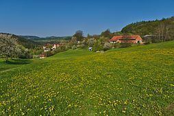 | ||
Lhota u Olešnice is a village and municipality (obec) in Blansko District in the South Moravian Region of the Czech Republic.
Map of 679 74 Lhota u Ole%C5%A1nice, Czechia
The municipality covers an area of 2.25 square kilometres (0.87 sq mi), and has a population of 38 (as at 3 July 2006).
Lhota u Olešnice lies approximately 28 kilometres (17 mi) north-west of Blansko, 43 km (27 mi) north-west of Brno, and 154 km (96 mi) south-east of Prague.
References
Lhota u Olešnice Wikipedia(Text) CC BY-SA