
Country United States Time zone Eastern (EST) Local time Thursday 12:37 PM | County Niagara Population 16,262 (2010) University Niagara University | |
 | ||
Weather -3°C, Wind W at 31 km/h, 51% Humidity Points of interest Earl W Brydges Artpark St, Basilica of the National, Castellani Art Museum, Devil's Hole State Park, Joseph Davis State Park | ||
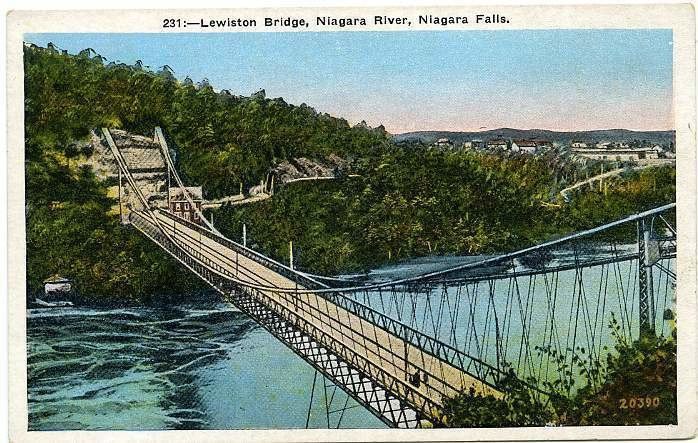
Lewiston is a town in Niagara County, New York United States. The population was 16,262 at the 2010 census. The town and its contained village are named after Morgan Lewis, a governor of New York.
Contents
- Map of Lewiston NY USA
- History
- Government
- Geography
- Communities and locations within Lewiston
- Adjacent cities and towns
- Demographics
- Affluence rating
- Economy
- Universities
- Public schools
- Private schools
- Healthcare
- Transportation
- In popular culture
- References
Map of Lewiston, NY, USA
The Town of Lewiston is on the western border of the county. The Village of Lewiston is within the town.
History
The Town of Lewiston was formed in 1818.
Government
The Town Supervisor is Steve Broderick and the Chief of Police is Frank Previte.
The Town Supervisor is considered the "Chief Fiscal Officer" for the Town. In this capacity, the officeholder oversees all finances as well as presiding at Town Board meetings, representing the Town for the Niagara County Water District, Niagara County Sewer District, Niagara Greenway Commission and Niagara Power Coalition. The Supervisor also serves as an ex-officio board member on various community organizations.
Five volunteer fire companies protect the Town of Lewiston. The Lewiston #1 (established 1914) and #2 (established 1942) fire companies, the Pekin Volunteer Fire Company (established 1932), the Sanborn Volunteer Fire Company, and the Upper Mountain Fire Company (established 1959).
Several federal, state, county and local law enforcement agencies protect the town. The United States Border Patrol is the federal agency. The New York State agencies are the New York State Police and the New York State Parks Police. The Niagara County Sheriff's Department assists the Lewiston Police Department which is the local authority.
Geography
According to the United States Census Bureau, the town has a total area of 41.0 square miles (106.3 km²), of which 37.3 square miles (96.5 km²) is land and 3.8 square miles (9.7 km²) (9.16%) is water.
The Niagara River forms the western boundary of the town, which is an international border with Canada. The Town of Lewiston's southern border is with the City of Niagara Falls, NY, the Town of Niagara, NY, and the Town of Wheatfield, NY. The southern portion of the town also is on the top of the Niagara Escarpment. The eastern border of the town is at Townline Road which separates the Towns of Cambria and Lewiston. The northern border of the town is with the Towns of Porter and Wilson.
New York State Route 104 passes across the town as "Lewiston Road" on top of the Niagara Escarpment and "Ridge Road" below the Escarpment. There are three exits of Interstate 190 in Lewiston. Exit 24 at Witmer Road New York State Route 31, Exit 25A at Military Road New York State Route 265, and Exit 25B for Route 104 and the Robert Moses State Parkway.
Communities and locations within Lewiston
Adjacent cities and towns
Demographics
As of the census of 2000, there were 16,257 people, 5,882 households, and 4,252 families residing in the town. The population density was 436.2 people per square mile (168.4/km²). There were 6,147 housing units at an average density of 164.9/sq mi (63.7/km²). The racial makeup of the town was 96.98% White, 0.92% Black or African American, 0.67% Native American, 0.58% Asian, 0.01% Pacific Islander, 0.34% from other races, and 0.49% from two or more races. Hispanic or Latino of any race were 0.91% of the population.
There were 5,882 households out of which 28.7% had children under the age of 18 living with them, 61.6% were married couples living together, 7.6% had a female householder with no husband present, and 27.7% were non-families. 24.1% of all households were made up of individuals and 11.8% had someone living alone who was 65 years of age or older. The average household size was 2.50 and the average family size was 2.98.
In the town, the population was spread out with 20.6% under the age of 18, 14.2% from 18 to 24, 23.1% from 25 to 44, 24.8% from 45 to 64, and 17.3% who were 65 years of age or older. The median age was 40 years. For every 100 females there were 89.8 males. For every 100 females age 18 and over, there were 86.3 males.
The median income for a household in the town was $50,819, and the median income for a family was $58,620. Males had a median income of $46,748 versus $26,848 for females. The per capita income for the town was $23,275. About 4.3% of families and 5.8% of the population were below the poverty line, including 7.1% of those under age 18 and 7.6% of those age 65 or over.
Affluence rating
In 2015, the Town of Lewiston was ranked the most affluent community in Niagara County and the eighth overall in Western New York. This ranking was based on raw statistics that came from the five-year version of the U.S. Census Bureau's 2013 American Community Survey, the latest source of official data at the local level. The categories ranged from basic measures (per capita income, median house value) to less familiar indicators (households with interest or dividend income, adults with advanced degrees).
Economy
Lewiston home to various business, sporting and entertainment venues, including:
Additionally, Lewiston has three museums:
Universities
Public schools
The Towns of Lewiston and Youngstown are predominantly served by the Lewiston-Porter Central School District, located on Creek Road. As of June 2015, Lewiston-Porter enrolled 2,077 students in K-12 and had district expenditures of $42,234,808. In 2014 Lewiston-Porter Central School District was the highest ranked school district (including both public and private high schools) in Niagara Country, and 9th overall in Western New York, in terms of overall academic performance. In 2015, Lewiston-Porter was rated 10th best in Western New York and 2nd in Niagara Country, behind Starpoint Central School District.
Niagara-Wheatfield Central School District also serves the Town of Lewiston with Niagara-Wheatfield High School, Edward Town Middle School, Colonial Village Elementary School, and West Street Elementary School all physically located in the Town of Lewiston.
Private schools
Within the Town of Lewiston, there are also several private schools:
Healthcare
There are several health-care facilities in the town. The Catholic Health ran Mount Saint Mary's Hospital (formed in 1907) is a six-floor facility that offers many differing kinds of high level healthcare. It also includes the "EmStar" emergency health facility. Adjacent to Mt. St. Mary's is the Our Lady of Peace nursing home.
Transportation
In popular culture
Lewiston is the smallest city in the history of The Amazing Race to host the finish line for an edition of the reality show; The Amazing Race 8 was completed there.