
Country United States City St. Louis ZIP code(s) Parts of 63108, 63113 Area 85 ha Area code 314 | State Missouri Wards 4, 18 Website stlouis-mo.gov Population 1,673 (2010) | |
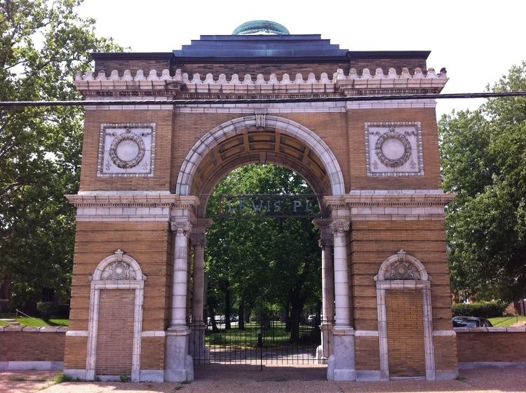 | ||
Lewis Place is a neighborhood of St. Louis, Missouri. Lewis Place is defined by Martin Luther King Drive on the North, Delmar Boulevard on the South, Newstead Avenue on the East, and Walton on the West.
Contents
Map of Lewis Place, St. Louis, MO, USA
History
Lewis Place was laid out in 1890 and was privately owned and developed by the family of William J. Lewis. The Lewis Place historic design recognizes the architectural significance of housing around the turn of the century. The architectural firm of Barnett, Haynes & Barnett has been admired by historic preservationists throughout the country.
Lewis Place is a three block street with the center parkway which is lined on both sides with beautiful homes built between 1890 and 1928. The housing stock reflects the ambiance of housing along the beautiful Euclid-Central West End area.
Lewis Place was placed on the National Register of Historic Landmarks on September 15, 1980. Lewis Place is situated in the midst of a revitalizing community with St. Louis University, Washington University and Ranken Technical College all within a three mile radius of the Lewis Place community.
Demographics
In 2010 Lewis Place's racial makeup was 94.2% Black, 5.4% White, 0.4% Native American, 0.2% Asian, 1.2% Two or More Races, and 0.7% Some Other Race. 0.9% of the population was of Hispanic or Latino origin.