
Elevation 450 m Local time Thursday 11:11 AM | Postal code 39807 Area 13.92 km² Population 285 (2005) | |
 | ||
Weather 12°C, Wind W at 16 km/h, 45% Humidity | ||
Lety is a village and municipality (obec) in Písek District in the South Bohemian Region of the Czech Republic. The municipality covers an area of 13.92 square kilometres (5.37 sq mi), and has a population of 285 (as at 2005).
Map of 398 04 Lety, Czechia
Lety lies approximately 25 kilometres (16 mi) north of Písek, 67 km (42 mi) north-west of České Budějovice, and 68 km (42 mi) south of Prague.
The hamlets Pukňov and Šerkov are administrative parts of Lety.
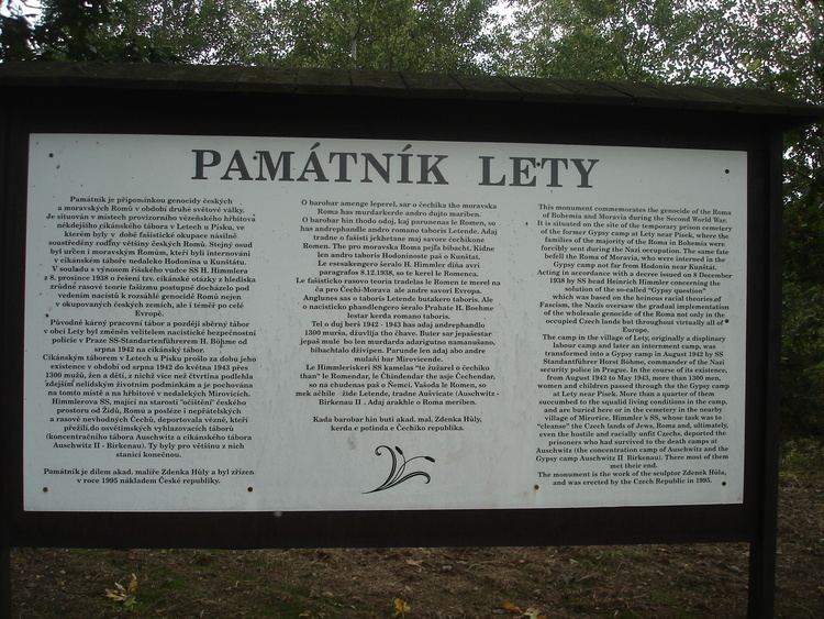
During World War II a concentration camp was established near Lety. The camp is most known for its role as a Gypsy camp. See concentration camps Lety and Hodonín for details.
References
Lety (Písek District) Wikipedia(Text) CC BY-SA