
Country United States Founded 1840 Elevation 250 m Local time Wednesday 8:08 AM Area code 865 | State Tennessee Settled 1810 Incorporated 1907 Area 16.1 km² Population 8,981 (2013) | |
 | ||
Weather -5°C, Wind NW at 11 km/h, 50% Humidity Named for | ||
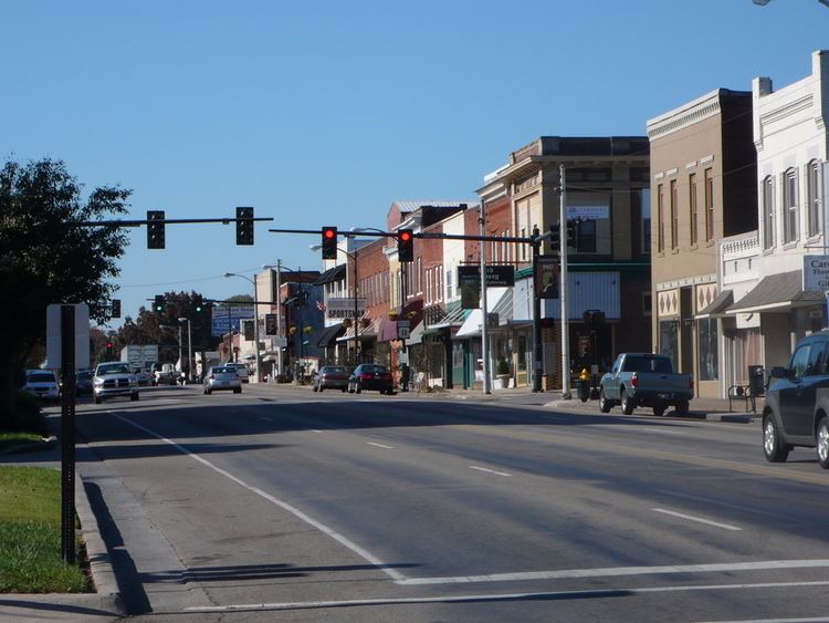
The belgian bistro and downtown lenoir city tennessee
Lenoir City is a city in Loudon County, Tennessee, United States. The population was 6,418 at the 2000 census and the population rose to 8,642 as of 2010. It is included in the Knoxville Metropolitan Area in the state's eastern region, along the Tennessee River southwest of Knoxville. Fort Loudoun Dam is nearby.
Contents
- The belgian bistro and downtown lenoir city tennessee
- Map of Lenoir City TN USA
- History
- Lenoir City Company
- 20th century
- 21st century
- Geography
- Demographics
- Government
- Education
- Lenoir City Schools
- Loudon County Schools within Lenoir City
- Climate
- Notable people
- References
Map of Lenoir City, TN, USA
History
Native Americans were living in the Lenoir City area for thousands of years before the arrival of the first European settlers. On Bussell Island, which lies across the Tennessee River to the south, archaeologists have discovered evidence of habitation dating to as early as the Archaic Period (8000–1000 B.C.). The island is also believed to have been the location of "Coste," a village visited by Hernando de Soto in 1540. The Cherokee called the Lenoir City area Wa'ginsi, and believed it to be the home of a large serpent that brought bad luck to anyone who saw it. By the early 19th century, an early East Tennessee pioneer, Judge David Campbell, had laid claim to part of what is now Lenoir City, where he had built a log cabin and a gristmill.
In the early 19th century, a 5,000-acre (2,000 ha) tract of land— which included what is now Lenoir City— was deeded to General William Lenoir as payment for his services in the American Revolutionary War. David Campbell and another early settler, Alexander Outlaw, filed a case against Lenoir in court, arguing they had already laid claim to parts of the Lenoir tract. After the case was settled in favor of Lenoir in 1809, Lenoir deeded the tract to his son, William Ballard Lenoir (1775–1852), who in 1810 moved to the tract and established a large plantation. Along with agricultural pursuits, which included producing hams from a herd of Berkshire hogs, Lenoir operated several small-scale industries, including a sawmill and flour mill. In the early 1830s, the Lenoir Cotton Mill— one of the earliest in the South— was completed along the banks of Town Creek.
After Lenoir's death, his estate was divided up among his children. His sons formed the William Lenoir and Brothers Company to manage the family's businesses. When the railroad reached the Lenoir estate in 1855, a depot was constructed, and the community of Lenoir Station developed around it.
During the Civil War, the Lenoirs supported the Confederacy, due in part to associations with Confederate-leaning business interests in Knoxville (one of William Ballard Lenoir's sons was married to the daughter of Knoxville historian and banker, J. G. M. Ramsey, who was an ardent Confederate). On June 20, 1863, a Union scouting expedition led by General William P. Sanders arrived at Lenoir Station after having failed to destroy the railroad trestle at Loudon. Sanders burned the depot as well as the Lenoirs' sawmill and flour mill. He spared the cotton mill, however, since there were few such mills in the area to provide cloth for the army, and because the Lenoirs were fellow Masons.
Lenoir City Company
In the late 1880s, an abundance of financial capital, the popularity of social theories regarding planned cities, and a thriving coal mining industry in East Tennessee's Cumberland Plateau region led to the establishment of a number of company towns throughout the Upper Tennessee Valley, most of which were funded by investors from the northeast or Knoxville. In 1889, Knoxville railroad magnate Charles McClung McGhee and his friend and associate, Edward J. Sanford, formed the Lenoir City Company, believing the Lenoir estate would be the ideal location for such a town. The company incorporated in April 1890 with $800,000 in stock, and purchased the Lenoir estate, which then consisted of 2,700 acres (1,100 ha), for $300 per acre. When the company issued the stock to the public, the investors each received stock in the company and a lot in the planned town.
Lenoir City was laid out in a grid pattern with four quadrants, west of Town Creek and north of the railroad tracks. The city's northwest quadrant would be a middle class and affluent residential area, whereas the northeast quadrant would be for the city's wage-workers. The southwest quadrant would contain blast furnaces, steel works, and other large factories, while the southeast quadrant would contain woodworking, furniture, and canning factories. Influenced by late 19th-century reform movements that stressed health and temperance, several lots were set aside for public parks, and a large garden area was planned between the railroad tracks and the river.
The Lenoir City Company struggled due to a recession that froze financial markets in the early 1890s. By 1892, the company had only sold 144 of the town's 3,448 lots. McGhee and Sanford persisted, however, and while it never developed in the grand fashion conceived, Lenoir City nevertheless survived. McGhee convinced a rail car company to open a factory in Lenoir City, and a short time later a knitting mill was established. Both establishments still employed several hundred workers in 1910.
20th century
Beginning in the 1930s, a series of federal government projects provided a needed boost to Lenoir City's economy. The Tennessee Valley Authority's construction of Fort Loudoun Dam and reservoir, which began in 1940, provided hundreds of locals with jobs, and brought a number of road improvements to the area. The creation of the Interstate Highway System in the 1950s and 1960s brought about the construction of I-75 and I-40— two trans-national highways that intersect just northeast of Lenoir City. U.S. Highway 321 was built through Lenoir City in the 1980s primarily to provide greater access to the Great Smoky Mountains National Park, some 40 miles (64 km) down the road in Blount County.
On February 21, 1993 at 5:05PM, an F-3 tornado touched down in eastern Roane County (just west of town) and tracked east-south-east directly towards the City. The tornado devastated parts of the city. Parts of Downtown, as well as the area near A Street and 5th Avenue were destroyed. This included major damage to the former Lenoir City High School/Middle School property (now River Oaks Place). The Tornado continued east-south-eastward going through the town of Friendsville before lifting in western Maryville. The death toll was 1 (in Lenoir City) and there were 55 injuries, per the NWS Tornado Database.
In March 1998, A historic landmark, the William B. Lenoir Hotel, the block of Broadway (US 11) between A and B Street, was destroyed by a massive fire. The entire block was lost due to what is called a common attic and basement, meaning that there were no firewalls between buildings. Wilburn's Barbershop, the Lenoir City Public Library, a Mexican grocery, TV Readers magazine, Habitat for Humanity, a school photography company along with a photo finishing lab, as well as several apartments were destroyed by the blaze. The ruins of the property were demolished and replaced by Roane State Community College, Tennessee Career Center, and a new state of the art Lenoir City Public Library.
21st century
In the early 2000s, Lenoir City continued to grow economically. U.S. Highway 321 saw by far the most growth, with new restaurants such as Ruby Tuesday, Chili's, Cracker Barrel, Aubrey's, and Zaxby's to name a few. The opening of a new Wal-mart Supercenter in 1998 sparked a lot of this growth. New stores included The Home Depot, Goody's Family Clothing (Now Defunct), Cato, and Blockbuster Video (Now Defunct). A new hospital, Fort Loudoun Medical Center, was built replacing the old Loudon Hospital in nearby Loudon.
In the late 2000s, two major commercial developments were announced. Creekwood Park was the first to announce new development. This is located parallel to I-75 between US-321 and US-70. A new four-lane road was built between the two highways. Shortly thereafter a luxury apartment complex was built on part of the site. Otherwise most of the site remained vacant for several years following completion of the new road. In 2014, development finally started commencing in the area with a few medical offices being built. From 2016 - 2017, the city constructed a new community center called "The Venue" and a new Headquarters for Lenoir City Utilities Board on a portion of the site.
Later, local physician and TV personality, Dr. Bob Overholt, announced that The Market at Town Creek would connect US-321 and Harrison Road near the Lenoir City High School and Middle School property. Several Businesses have opened on the property, including a new Food City grocery store, Bojangles, Knoxville TVA Employees Credit Union, AT&T Store, Pizza Hut, and a tanning salon. In 2013 the long awaited Town Creek Parkway, a four-lane road connecting US-321 and Harrison Road, was completed.
In 2016, the city inaugurated its first female city councilwoman, Jennifer Wampler, whom was appointed to fill out the remainder of the term vacated by her husband, Harry Wampler, upon his death.
Geography
Lenoir City is located at 35°47′51″N 84°16′16″W (35.797618, -84.271103). The Tennessee River and TVA's Fort Loudoun and Watts Bar reservations provide the city's southern boundary. Four major federal highways pass through Lenoir City: U.S. Route 11, which runs roughly parallel to the river shore, traverses the city east-to-west; U.S. Route 321, which crosses Fort Loudon Dam south of the city, traverses the city north-to-south. Interstate 75 and U.S. Route 70 intersect US-321 in the northern part of the city. US-321 terminates at Interstate 40 just north of the city.
Lenoir City is traditionally spread out along US-11, west of the road's junction with US-321. This section of the city still roughly follows a grid plan laid out in the 1890s. In recent decades, Lenoir City has annexed a 5-mile (8.0 km) corridor of land along US-321 between its US-11 intersection and I-40 intersection. This corridor contains the city's newer, commercial area that caters to the high volume of traffic brought to the area by I-75 and I-40.
Demographics
As of the census of 2010, there were 8,642 people, 3,369 households, and 2,183 families residing in the city. There were 3,703 housing units. The racial makeup of the city was 87.30% White, 1.60% African American, 0.50% Native American, 0.60% Asian, 0.30% Pacific Islander, 8.0% from other races, and 1.80% from two or more races. Hispanic or Latino of any race were 17.50% of the population.
As of the 2000 census, there were 2,910 households out of which 30.4% had children under the age of 18 living with them, 44.5% were married couples living together, 13.8% had a female householder with no husband present, and 37.6% were non-families. 33.2% of all households were made up of individuals and 14.7% had someone living alone who was 65 years of age or older. The average household size was 2.33 and the average family size was 2.95.
In the city, the population was spread out with 25.0% under the age of 18, 9.3% from 18 to 24, 30.3% from 25 to 44, 20.8% from 45 to 64, and 14.6% who were 65 years of age or older. The median age was 35 years. For every 100 females there were 90.3 males. For every 100 females age 18 and over, there were 85.5 males.
The median income for a household in the city was $28,889, and the median income for a family was $33,462. Males had a median income of $27,229 versus $20,744 for females. The per capita income for the city was $16,632. About 13.4% of families and 16.0% of the population were below the poverty line, including 22.1% of those under age 18 and 8.9% of those age 65 or over.
Government
The City of Lenoir City operates under a Mayor/City Council Form. The mayor is elected on 4 year terms. The City Council is elected every 4 years.
Education
Residents are zoned to both city and county schools. Because of the proximity of the county schools to Lenoir City and the distance to the county high schools (Loudon High School and Greenback School), most students who attend county schools within the city through elementary and middle grades (Kindergarten through eighth) transfer to the city school system upon enrolling in high school.
Lenoir City Schools
Loudon County Schools within Lenoir City
Climate
The climate in this area is characterized by relatively high temperatures and evenly distributed precipitation throughout the year. According to the Köppen Climate Classification system, Lenoir City has a Humid subtropical climate, abbreviated "Cfa" on climate maps.