
Country Norway District Namdalen Area rank 380 in Norway Area 109.5 km² Local time Wednesday 8:50 AM | County Nord-Trøndelag Administrative centre Leknes Demonym(s) Lekværing Population 589 (2011) Official language form Norwegian Language | |
 | ||
Weather -1°C, Wind W at 26 km/h, 88% Humidity Points of interest Silsanden, Storbesanden, Årdalssanden, Langstranda | ||
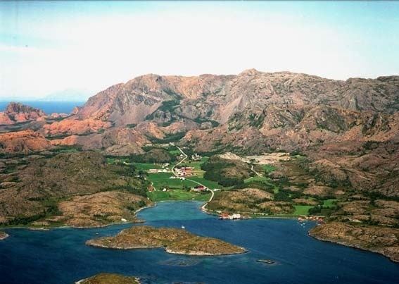
Leka is a municipality in Nord-Trøndelag county, Norway. It is part of the Namdalen region. The administrative centre of the municipality is the village of Leknes. Other villages include Sør-Gutvika and Madsøygrenda.
Contents
- Map of Leka Norway
- Toponomy
- History
- General information
- Coat of arms
- Churches
- Geography
- Government
- Municipal council
- Politics
- Transportation
- References
Map of Leka, Norway
Primarily a fishing and farming community, Leka is the northernmost municipality in Trøndelag. The island has been inhabited for at least 10,000 years, as evidenced by cave drawings in the Solsem section of the island.
Toponomy
The Old Norse form of the name was Leka. The meaning of the name is unknown, but it may come from the word lekke which can mean "gravelly ground".
History
Dated to the Viking Age, the burial mound Herlaugshaugen is one of the largest (in Norway) from that era.
General information
The municipality of Leka was established on 1 October 1860 when it was separated from the large municipality of Kolvereid. Initially, the population of Leka was 1,702. On 1 January 1909, the southern district of Leka (population: 881) was separated from Leka to form the new municipality of Gravvik. This left Leka was 1,209 residents. The borders of Leka have not changed since then.
Coat-of-arms
The coat-of-arms is from modern times; they were granted on 21 April 1989. The arms show the golden wing and claw of an eagle on a red background. (In 1932 a child disappeared on the island, and was refound by an eagles nest.)
Churches
The Church of Norway has one parish (sokn) within the municipality of Leka. It is part of the Namdal deanery in the Diocese of Nidaros.
Geography
Leka is an island municipality encompassing the main island of Leka, the western part of the island of Austra (with the biggest locality being Gutvik), and many other small islands in the surrounding area. The tiny island groups of Sklinna and Horta lie to the west of the main islands. Sklinna Lighthouse is located in the westernmost part of the municipality. Leka borders Vikna and Nærøy municipalities to the south and Bindal (in Nordland county) to the north.
Government
All municipalities in Norway, including Leka, are responsible for primary education (through 10th grade), outpatient health services, senior citizen services, unemployment and other social services, zoning, economic development, and municipal roads. The municipality is governed by a municipal council of elected representatives, which in turn elect a mayor.
Municipal council
The municipal council (Kommunestyre) of Leka is made up of 15 representatives that are elected to every four years. Currently, the party breakdown is as follows:
Politics
In the 2007 municipal elections, Leka had the highest vote for the Centre Party in Norway, at 69.3 per cent.
Transportation
The island part of Leka (Skei) is connected to Gutvik by a ferry line, operated by Lekaferja.