
Length 75 km | Basin size 1,917 km (740 sq mi) | |
 | ||
River mouth southwest of Leer into the Ems1 m above sea level (NN) | ||
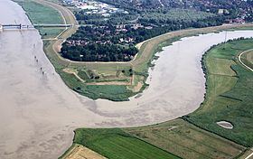
The Leda is a river in north-western Germany in the state of Lower Saxony. It is a right tributary of the Ems and originates at the confluence of the Sagter Ems and the Soeste (Dreyschloot) near the town of Barßel. The Leda flows into the Ems near the town of Leer. On the southern bank of the Leda, in the Overledingen Land (Overledingen="country over the Leda"), opposite Leer, lies the small settlement of Kloster Muhde (Muhde from the Old Frisian mutha meaning "(river) mouth"). The total length of the river is 29 kilometres (18 mi), of which the lower 1.9 kilometres (1.2 mi) are navigable for sea-going vessels.
Map of Leda, Germany
In East Frisia the Sagter Ems, a headstream of the Leda, is also known as the Leda.
References
Leda (river) Wikipedia(Text) CC BY-SA