
OS grid reference SJ466184 Post town SHREWSBURY Local time Tuesday 1:04 PM | Sovereign state United Kingdom Postcode district SY4 Dialling code 01743 | |
 | ||
Weather 13°C, Wind SW at 24 km/h, 80% Humidity | ||
Leaton is a small village in Shropshire, England.
Map of Leaton, Shrewsbury, UK
It is situated on the B5067, Shrewsbury to Baschurch road, in the parish of Pimhill.
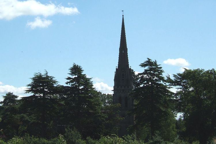
The village has an impressive church, the Holy Trinity. This was built in 1859, with the tower added in 1872, by Shrewsbury architect Samuel Pountney Smith.
The Shrewsbury to Chester Line runs through, though the nearest railway station is at Shrewsbury, as the former Leaton railway station closed to passengers in 1960. The signal box went in 1988, but today there remains a level crossing. A small industrial estate now exists at the former railway sidings.
There once existed the Leaton Brick and Pipe Works, one of a number of clay-based industries in the area.
Just to the south of Leaton is the hamlet of Dunnsheath.