
Local time Tuesday 3:53 AM | ||
 | ||
Weather 5°C, Wind E at 8 km/h, 57% Humidity | ||
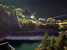
Le Châtelard (altitude 1,120 m or 3,675 ft) is a locality in the canton of Valais, Switzerland near the border with France. It is part of the municipality of Finhaut.
Contents
Map of Ch%C3%A2telard, 1925 Finhaut, Switzerland
Transportation
The 1,000 mm (3 ft 3 3⁄8 in) metre gauge Chemin de Fer de Martigny au Châtelard and Ligne de Saint Gervais - Vallorcine make an end to end connection here. There is a road from Martigny via the Forclaz pass. This Road continues across the French border to Vallorcine and then beyond to Chamonix.
From Le Châtelard a funicular leads to the Lac d'Emosson.
References
Le Châtelard, Valais Wikipedia(Text) CC BY-SA