
Time zone CET (UTC+1) Area 5.13 km² | INSEE/Postal code 69024 / 69620 Population 1,823 (1999) | |
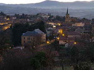 | ||
Le Bois-d'Oingt is a commune located in the Rhône in the Auvergne-Rhône-Alpes region, in eastern France.
Contents
Map of 69620 Le Bois-d'Oingt, France
Geography
Le Bois d'Oingt's acreage is of 1.976 square mile (512 hectares), and it lies at 350 meters altitude.
The inhabitants of Bois d’Oingt are called the “buisantins”.
References
Le Bois-d'Oingt Wikipedia(Text) CC BY-SA