
Elevation 455 m Population 599 (1 Jan 2014) | Postal code 582 86 Area 18.2 km² | |
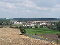 | ||
Leština u Světlé is a village and municipality (obec) in Havlíčkův Brod District in the Vysočina Region of the Czech Republic.
Map of Le%C5%A1tina u Sv%C4%9Btl%C3%A9, Czechia
The municipality covers an area of 18.2 square kilometres (7.0 sq mi), and has a population of 636.
Leština u Světlé lies approximately 23 kilometres (14 mi) north-west of Havlíčkův Brod, 44 km (27 mi) north of Jihlava, and 79 km (49 mi) south-east of Prague.
References
Leština u Světlé Wikipedia(Text) CC BY-SA