
Country United States County Brunswick Time zone Eastern (EST) (UTC-5) Zip code 23868 Population 1,093 (2013) | State Virginia Elevation 266 ft (81 m) Area code(s) 434 Local time Monday 6:54 PM University Saint Paul's College | |
 | ||
Weather 2°C, Wind NE at 11 km/h, 91% Humidity | ||
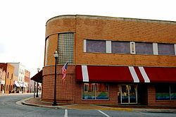
Lawrenceville is a town in Brunswick County, Virginia, United States. The population was 1,438 at the 2010 census. Located by the Meherrin River, it is the county seat of Brunswick County. In colonial times, Lieutenant Governor Alexander Spotswood had a stockade built nearby, called Fort Christanna, where converted Native American allies were housed and educated.
Contents
Map of Lawrenceville, VA 23868, USA
Historically black Saint Paul's College, founded in 1888 and affiliated with the Episcopal Church, operated here until 2013. Lumber, tobacco, livestock, and other farm products are grown in the area. In a county along the southern border of the state, the town is near the northernmost area for cotton growing.
History
The county was an area of tobacco production in colonial times, and later mixed farming, both dependent on enslaved African-American workers. In addition to Fort Christanna and St. Paul's College, the Brunswick County Courthouse Square, Gholson Bridge, and Lawrenceville Historic District are listed on the National Register of Historic Places. In the 21st century, the economy is also based on lumber, livestock and farm products.
Geography
Lawrenceville is located at 36°45′30″N 77°51′2″W (36.758430, -77.850424).
According to the United States Census Bureau, the town has a total area of 0.9 square miles (2.4 km²), all of it land.
Demographics
As of the census of 2000, there were 1,275 people, 376 households, and 209 families residing in the town. The population density was 1,391.1 people per square mile (535.1/km²). There were 459 housing units at an average density of 500.8 per square mile (192.6/km²). The racial makeup of the town was 33.25% White, 64.63% African American, 0.31% Native American, 0.24% Asian, and 1.57% from two or more races. Hispanic or Latino of any race were 1.41% of the population.
There were 376 households out of which 24.5% had children under the age of 18 living with them, 35.1% were married couples living together, 13.8% had a female householder with no husband present, and 44.4% were non-families. 39.6% of all households were made up of individuals and 21.3% had someone living alone who was 65 years of age or older. The average household size was 2.35 and the average family size was 3.16.
In the town, the population was spread out with 17.3% under the age of 18, 33.2% from 18 to 24, 17.5% from 25 to 44, 18.2% from 45 to 64, and 13.8% who were 65 years of age or older. The median age was 25 years. For every 100 females there were 76.6 males. For every 100 females age 18 and over, there were 73.4 males.
The median income for a household in the town was $28,594, and the median income for a family was $41,875. Males had a median income of $31,583 versus $18,056 for females. The per capita income for the town was $12,353. About 12.7% of families and 21.8% of the population were below the poverty line, including 23.2% of those under age 18 and 18.8% of those age 65 or over.