
- elevation 148 m (486 ft) - average 0.11 m/s (4 cu ft/s) | - elevation 50 m (164 ft) | |
 | ||
- max 0.8 m/s (28 cu ft/s) (15 September 1968) | ||
The Law Brook or Postford Brook is a Surrey stream, a tributary of the Tillingbourne which in turn flows into the River Wey. It is notable in its own right chiefly for its industrial heritage.
CourseEdit
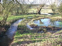
The stream is about 7 km long and flows in a generally NW direction towards the Vale of Holmesdale. It rises at various sources above Peaslake on the northern slopes of the Greensand Ridge. It drains the northern Winterfold Forest/Hurtwood Forest: the upper half of the catchment area is mostly forest with some pasture other than Peaslake. The lower course flows between the clustered village of Brook/Little London in Albury on the right bank, and Blackheath, a sparsely-inhabited wooded plateau, on the left bank.
It forms part of the boundary between the civil parishes of Albury and St Martha which contains most of Chilworth. Like the Tillingbourne, the lower Law Brook was harnessed by the construction of leats (narrow cuts) and mill ponds to provide power for industrial mills, including a long leat dividing Chilworth and supplying its largest pond, known today as The Fish Pond, Chilworth.
The North Downs Line runs roughly parallel to the Brook for about 2 km.