
OS grid reference NY476624 Post town CARLISLE Dialling code 01228 | Sovereign state United Kingdom Postcode district CA6 | |
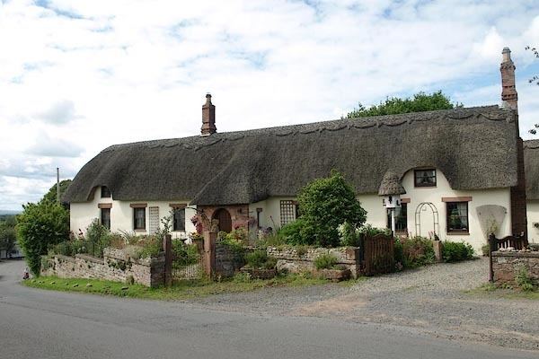 | ||
Laversdale is a village in Cumbria, England, situated to the north of Carlisle Lake District Airport. One of its more distinctive buildings is a thatched tithe barn, now a private house. The manor of Laversdale traditionally lies within the parish and bailiwick of Irthington [1] in the Barony of Gilsland, and covers 3200 acres. It was held by the Earl of Carlisle until the 1980's.
Map of Laversdale, Carlisle, UK
A turf section of Hadrian's Wall passes through the old manor boundaries just to the south of the village. Milecastle 60 would have been placed here although its exact location is uncertain. In 1851 a Roman altar was ploughed up near the likely spot. Dedicated to Cocidius, it was erected by the Sixth Legion.
There are no shops or other amenities in Laversdale following the closure of the village pub (The Sportsman Inn). The parish church is St. Kentigern's, in Irthington.