
Elevation 460 m (1,510 ft) Postal code 98530 Area 120 ha | Republic Crimea Time zone MSK (UTC+4) Area code +380 6560 | |
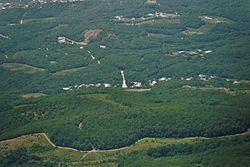 | ||
Lavanda (Ukrainian: Лаванда; Russian: Лаванда) is a rural settlement (Ukraine) in the Alushta Municipality of the Autonomous Republic of Crimea, a territory recognized by a majority of countries as part of Ukraine and annexed by Russia as the Republic of Crimea. The word literally means "lavender."
Map of Lavanda
Lavanda is located on Crimea's southern shore at an elevation of 460 metres (1,510 ft). It is administratively subordinate to the Luchyste Village Council. Its population was 177 in the 2001 Ukrainian census. Current population: Population: 206 (2014 Census). The M18 highway runs near the settlement.
References
Lavanda, Crimea Wikipedia(Text) CC BY-SA