
Country United States ZIP code 99146 Elevation 504 m Population 1 (2010) Number of airports 1 | Time zone Pacific (PST) (UTC-8) Area code(s) 509 Area 16 ha Local time Monday 9:59 AM | |
 | ||
Weather 4°C, Wind SE at 5 km/h, 86% Humidity | ||
How to say or pronounce usa cities laurier washington
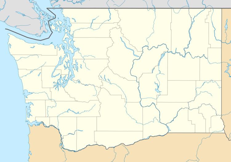
Laurier is a location in Ferry County, Washington that neighbors the Canada–United States border. The nearest school district is Orient School District. According to the 2010 census, there was one person residing at this location. It is a census-designated place.
Contents
Map of Laurier, WA 99146, USA
Laurier was named for Sir Wilfrid Laurier, prime minister of Canada from 1896 to 1911. The federal U.S. General Services Administration lists three buildings in Laurier – a border station and two border station residences – all built in 1936. U.S. Route 395 runs through the community north to the Canada–US border, where it becomes British Columbia Highway 395. The Avey Field State Airport is in Laurier and its runway crosses the border into British Columbia.
Climate
This climatic region is typified by large seasonal temperature differences, with warm to hot (and often humid) summers and cold (sometimes severely cold) winters. According to the Köppen Climate Classification system, Laurier has a humid continental climate, abbreviated "Dfb" on climate maps.