
- location west of Lester Length 38 km Basin area 146 km² Mouth Clear Fork | - location Oceana Basin area 146.1 km² Source elevation 778 m Country United States of America | |
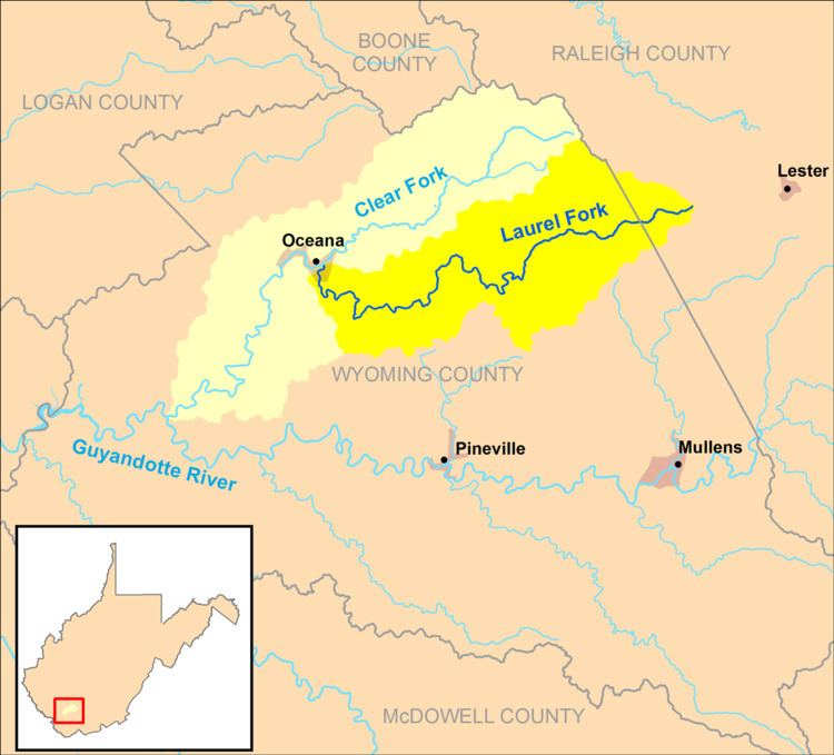 | ||
The Laurel Fork is a tributary of the Clear Fork, 23.5 miles (37.8 km) long, in southern West Virginia in the United States. Via the Clear Fork and the Guyandotte and Ohio rivers, it is part of the watershed of the Mississippi River, draining an area of 56.4 square miles (146 km2) in a rural area on the unglaciated portion of the Allegheny Plateau.
Map of Laurel Fork, West Virginia, USA
The Laurel Fork rises in western Raleigh County, approximately 4 miles (6.4 km) west of Lester, and flows generally westward through northern Wyoming County, through the unincorporated communities of Glen Rogers, Ravencliff, Sabine, Glen Fork, Jesse, Matheny, and Edith, to the town of Oceana, where it flows into the Clear Fork from the east. Downstream of Jesse, the stream is paralleled by West Virginia Route 10.