
Country Germany Admin. region Freiburg Elevation 279 m (915 ft) Area 15.01 km² Postal code 77886 Dialling code 07841 | State Baden-Württemberg District Ortenaukreis Time zone CET/CEST (UTC+1/+2) Local time Monday 1:53 PM Population 3,866 (31 Dec 2008) Administrative region Freiburg | |
 | ||
Weather 12°C, Wind N at 11 km/h, 48% Humidity | ||
Lauf is a community in the district of Ortenau in Western Baden-Württemberg, Germany.
Map of Lauf, Germany
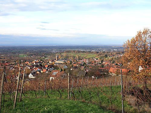
Lauf is situated on the western edge of the Black Forest (Schwarzwald), located in a valley (Laufbachtal) that slopes roughly east-west. The Laufbach stream which gives Lauf its name rises on the north-west side of the Hornisgrinde, and descends rapidly past the Glashutte towards Lauf. In the Laufbachtal and side valleys, native vegetation flourishes, including orchids.
Vineyards are a major land-use, as the village has a good number of south-facing slopes. The local landscape consists of orchards, meadows and forest.
The population in July 2006 was 3,980 persons, compared to 900 in 1692.
The Lauf coat of arms shows a red goblet on a silver background; emerging from both sides of the cup are clusters of grapes with leaves.
Places to eat in Lauf: Rebstock (Hauptstraße), Linde (Schlossstraße)
Bar in Lauf: Rabenkeller (Hauptstraße opposite the town hall).
Places to stay: Pension Hornenberg (Hornenbergstrasse) Gasthaus zur Linde (Schlossstrasse)