
Country Honduras Area 78 km² | Department Lempira | |
 | ||
Municipality since 1 January 1869; 148 years ago (1869-01-01) | ||
Las Flores is a municipality in the Honduran department of Lempira.
Contents
Map of Las Flores, Honduras
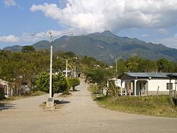
Las Flores is one of the municipalities of the Lempira department. It is located at 17 km from Gracias on the paved road that leads to Santa Rosa de Copán. The town is 200 meters away from the paved road.
History
The very first settlers were from La Paz department. It was first called "Las Flores de Santa Bárbara", honoring the image of the saint of that place. It was granted the category of municipality on 1 January 1869.
Geography
This municipality is in a valley, near to a river. The vegetation corresponds to dry sub-tropical forests. The weather is hot since it is in a valley. There are some hills around it but they are not so high or steep.
Boundaries
Its boundaries are:
Population
In this case 90% of the people are cross-breed of native Indians and Spanish settlers.
Tourism
A 1 hour visit to the downtown of Las Flores will do to get to know it. There are several places to go swimming because of the rivers. There are a couple of places with internet access.