
District Verden Time zone CET/CEST (UTC+1/+2) Area 76.11 km² Local time Sunday 4:20 PM | Elevation 22 m (72 ft) Postal codes 27299 Population 14,637 (31 Dec 2008) Postal code 27299 | |
 | ||
Weather 11°C, Wind E at 24 km/h, 48% Humidity | ||
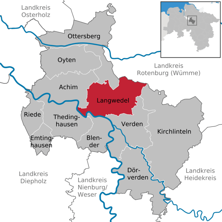
Langwedel is a municipality in the district of Verden, in Lower Saxony, Germany. It is situated on the right bank of the Weser, approx. 7 km northwest of Verden, and 30 km southeast of Bremen.
Map of 27299 Langwedel, Germany
Langwedel belonged to the Prince-Bishopric of Verden, established in 1180. In 1648 the Prince-Bishopric was transformed into the Principality of Verden, which was first ruled in personal union by the Swedish Crown - interrupted by a Danish occupation (1712–1715) - and from 1715 on by the Hanoverian Crown. The Kingdom of Hanover incorporated the Principality in a real union and the Princely territory, including Langwedel, became part of the new Stade Region, established in 1823.
References
Langwedel Wikipedia(Text) CC BY-SA