
Width 5 km (3.1 mi) Highest point Rypdalstinden Area 30.3 km² | Length 11 km (6.8 mi) Highest elevation 802 m (2,631 ft) Municipality Bodø | |
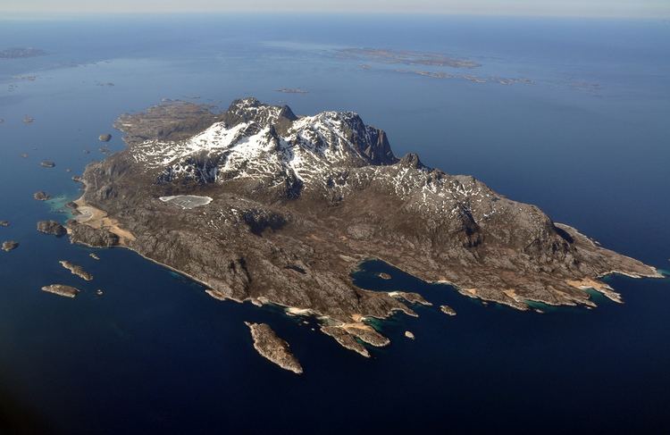 | ||
Landegode is an island at the municipality of Bodø in Nordland county, Norway. The 30.3-square-kilometre (11.7 sq mi) island is located about 10 kilometres (6.2 mi) northwest of the town of Bodø and about 14 kilometres (8.7 mi) east of the Helligvær islands. The highest point on the mountainous island is the 802-metre (2,631 ft) tall Rypdalstinden.
Map of Landegode, 8098 Landegode, Norway
Most of the islanders live in the southern village of Fenes. Landegode Church is also located in Fenes. Just off of the north end of the island, there are two lighthouses: Landegode Lighthouse and Bjørnøy Lighthouse.
References
Landegode Wikipedia(Text) CC BY-SA