
Founded February 8, 1877 Area 1,567 km² Unemployment rate 5.9% (Apr 2015) | Congressional district 4th Website www.lamarcountyal.com Population 14,236 (2013) | |
 | ||
Named for Lucius Quintus Cincinnatus Lamar Rivers Buttahatchee River, Luxapallila Creek, Yellow Creek | ||
Lamar county alabama dui lawyer attorney for lamar county al dui arrest
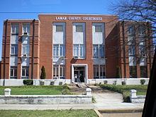
Lamar County (formerly Jones County and Sanford County) is a county of the U.S. state of Alabama. As of the 2010 census, the population was 14,564. Its county seat is Vernon and is a prohibition or dry county. Its name is in honor of Lucius Quintus Cincinnatus Lamar, member of the United States Senate from Mississippi.
Contents
- Lamar county alabama dui lawyer attorney for lamar county al dui arrest
- Map of Lamar County AL USA
- History
- Geography
- Adjacent counties
- Cemeteries
- Demographics
- 2010 census
- Newspapers
- Major highways
- Rail
- Cities
- Towns
- Unincorporated communities
- References
Map of Lamar County, AL, USA
History
Jones County, Alabama was established on February 4, 1867, with land taken from the southern part of Marion County and the western part of Fayette County, and it was named for E. P. Jones of Fayette County, with its county seat at Vernon. This county was abolished on November 13, 1867. On October 8, 1868, the area was again organized into a county, but as Covington County had been renamed "Jones County" the same year (a change that lasted only a few months), the new county was named Sanford, in honor of H. C. Sanford of Cherokee County. On February 8, 1877, the county was renamed Lamar in honor of Senator L.Q.C. Lamar of Mississippi.
Geography
According to the U.S. Census Bureau, the county has a total area of 605 square miles (1,570 km2), of which 605 square miles (1,570 km2) is land and 0.6 square miles (1.6 km2) (0.1%) is water.
Adjacent counties
Cemeteries
Demographics
As of the census of 2000, there were 15,904 people, 6,468 households, and 4,715 families residing in the county. The population density was 26 people per square mile (10/km2). There were 7,517 housing units at an average density of 12 per square mile (5/km2). The racial makeup of the county was 86.87% White, 11.98% Black or African American, 0.11% Native American, 0.06% Asian, 0.46% from other races, and 0.51% from two or more races. 1.30% of the population were Hispanic or Latino of any race.
There were 6,468 households out of which 31.40% had children under the age of 18 living with them, 58.60% were married couples living together, 10.90% had a female householder with no husband present, and 27.10% were non-families. 25.40% of all households were made up of individuals and 12.10% had someone living alone who was 65 years of age or older. The average household size was 2.43 and the average family size was 2.89.
In the county, the population was spread out with 23.60% under the age of 18, 8.70% from 18 to 24, 27.70% from 25 to 44, 24.10% from 45 to 64, and 15.90% who were 65 years of age or older. The median age was 38 years. For every 100 females there were 93.40 males. For every 100 females age 18 and over, there were 90.90 males.
The median income for a household in the county was $28,059, and the median income for a family was $33,050. Males had a median income of $30,453 versus $18,947 for females. The per capita income for the county was $14,435. About 13.30% of families and 16.10% of the population were below the poverty line, including 19.10% of those under age 18 and 18.60% of those age 65 or over.
2010 census
As of the census of 2010, there were 14,564 people, 6,103 households, and 4,207 families residing in the county. The population density was 24 people per square mile (9/km2). There were 7,354 housing units at an average density of 12 per square mile (5/km2). The racial makeup of the county was 86.7% White, 11.3% Black or African American, 0.2% Native American, 0.0% Asian, 0.6% from other races, and 1.3% from two or more races. 1.2% of the population were Hispanic or Latino of any race.
There were 6,103 households out of which 26.1% had children under the age of 18 living with them, 53.2% were married couples living together, 11.6% had a female householder with no husband present, and 31.1% were non-families. 28.8% of all households were made up of individuals and 13.3% had someone living alone who was 65 years of age or older. The average household size was 2.35 and the average family size was 2.8.
In the county, the population was spread out with 22.2% under the age of 18, 7.2% from 18 to 24, 22.5% from 25 to 44, 29.3% from 45 to 64, and 18.8% who were 65 years of age or older. The median age was 43.5 years. For every 100 females there were 95.0 males. For every 100 females age 18 and over, there were 99.4 males.
The median income for a household in the county was $33,887, and the median income for a family was $42,492. Males had a median income of $36,833 versus $25,125 for females. The per capita income for the county was $19,789. About 13.2% of families and 18.5% of the population were below the poverty line, including 25.2% of those under age 18 and 14.6% of those age 65 or over.