
Type Artificial lake Max. length 6 mi (9.7 km) Surface area 1,580 acres (6.4 km) Area 6.394 km² Width 610 m | Basin countries Canada Max. width 2,000 ft (610 m) Surface elevation 468 m Length 9.7 km Catchment area 3,263 km² | |
 | ||
Location | ||
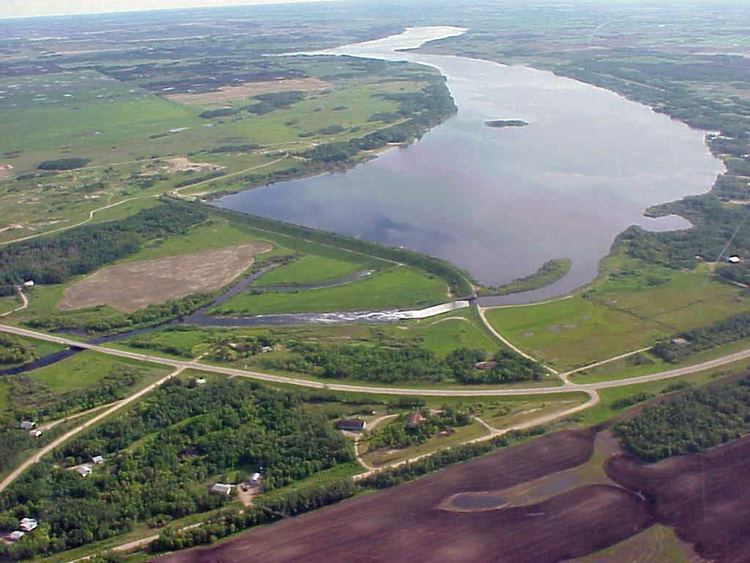
Lake Wahtopanah, also known as Rivers Reservoir, is a lake on the Little Saskatchewan River near the town of Rivers, Manitoba. Its dam was built by the Prairie Farm Rehabilitation Administration in 1960 to supplement water supplies for irrigation. It also provides the water supply for the town of Rivers, stock watering and recreation. The reservoir is about 2,000 feet (610 m) wide and six miles (10 km) long. The deepest point is about 50 feet (15 m). Riparian flows are regulated by a four-foot square gated conduit. High flows pass over a 110-foot (34 m) wide concrete chute spillway. The reservoir stores about 24,500 acre feet (30,200,000 m3) and covers an area of about 1,580 acres (6.4 km2). The drainage area is about 1,260 square miles (3,300 km2) and extends well into Riding Mountain National Park. The province maintains a park and campground on the west shore. The name is an alternate form of the Native word watopapinah meaning "canoe people".