
Primary inflows Max. length 2.89 miles (4.65 km) Area 14.41 km² Length 4.65 km Inflow source Little Manatee River | Basin countries United States Max. width 2.38 miles (3.83 km) Mean depth 1.46 m Width 3.83 km | |
 | ||
Type manmade reservoir freshwater lake | ||
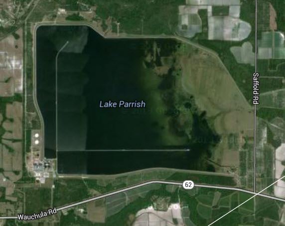
Lake Parrish, built in the middle of the 1970s by Florida Power & Light (FPL), is a lake that provides water to be used for the Manatee power plant. This lake is surrounded by grassland, except on the southwest corner, where the power plant is located. This lake is somewhat rectangular and is surrounded on the south, west, north and the northeast by a long levee. Two access roads originate at the power plant and extend into the lake far to the north and east. State Road 62 is roughly 1,000 feet (300 m) south of Lake Parrish.
Map of Lake Parrish, Florida 34219, USA
Lake Parrish is privately owned, so it has no public boat ramps and swimming is not allowed in the lake. However, the public is allowed by FPL to fish the lake. GORP says the lake has excellent fishing, but nowhere does this website or any other say what types of fish are in the lake.