
Type Artificial lake Surface area 11 km (4.2 sq mi) Length 9 km | Primary inflows Area 11 km² Width 1.5 km | |
 | ||
Similar | ||
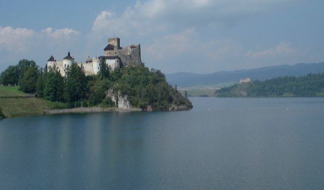
Lake Czorsztyn (Polish: Jezioro Czorsztyńskie) is a man-made reservoir on the Dunajec river, southern Poland, between the Pieniny and the Gorce Mountains. It owes its existence to a dam, which is located in the village of Niedzica.
Map of Lake Czorsztynskie, Poland
The dam itself was completed in 1995. Its measurements are: 56 meters high, 400 meters long and 7 meters wide on top. The lake has the area ranging from 4,15 km2. to 13,35 km2. Usually, its area is app. 11 km2., with the length of 9 kilometers and width of 1,5 km. Maximum depth is 50 meters, and average depth is 17,6 meters. Total length of the shoreline is 29,7 km. Below the dam there is a much smaller Sromowce Lake, which regulates the water level of Czorsztyn Lake.
Main purpose of the reservoir is to prevent floods in the Dunajec river valley. Furthermore, it attracts a growing number of tourists. The dam is equipped with a 92 megawatt power plant. The lake is located in close proximity of several popular tourist spots, such as Pieniny National Park, Niedzica Castle, Czorsztyn Castle, and the tourist village of Kluszkowce. Among villages located by Czorsztyn Lake are Niedzica, Falsztyn, Frydman, Dębno Podhalańskie, Maniowy, Kluszkowce and Czorsztyn.