
Surface area 640 acres (260 ha) Settlements Lake Carroll Surface elevation 225 m | Basin countries United States Frozen December to March Area 259 ha | |
 | ||
Location | ||
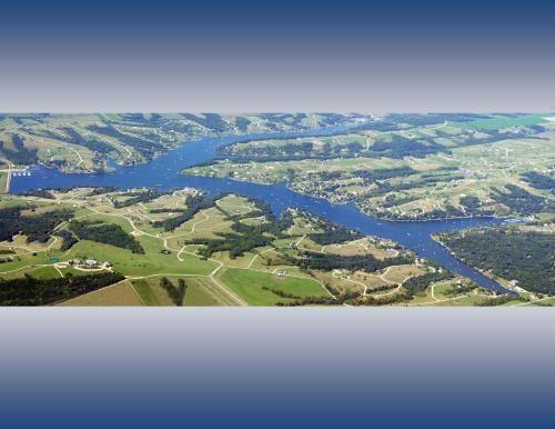
Lake Carroll is a reservoir in Carroll County, Illinois, located north of Lanark. The lake is the largest private lake in the state of Illinois, which contains 22 miles of shoreline and 636 acres of water.
Contents
Map of Lake Carroll, Illinois 61046, USA
GeographyEdit
Lake Carroll is located at 42°10′48″N 89°53′24″W (42.1800213, -89.8901216), at an elevation of 738 feet (225 m). Lake Carroll is located in the northwestern corner of Illinois.
HistoryEdit
In 1970, Russwood Inc. purchased 5,000 acres of land for 50 million dollars and began to create the second home community known as Lake Carroll. The company went bankrupt and foreclosed in 1976. The property put in a trust until it was transferred to the Lake Carroll Property Owners Association in 1990.
CreationEdit
The Lake is a reservoir, which means that it was man made. In 1974, A dam across the east fork of Plum River formed the lake. In the process, approximately 1 mile of Illinois Route 64 and U.S. Route 52 would be inundated along with two farms and their existing outbuildings.