
Population 3,518 (2011 census) Postcode(s) 4341 Parish Laidley Postal code 4341 | Established 1858 Founded 1858 Local time Saturday 6:06 PM Federal division Division of Blair | |
 | ||
Weather 27°C, Wind NE at 21 km/h, 55% Humidity Points of interest Das Neumann Haus, Laidley Pioneer Village and Museum, Lions Park (Narda Lagoon Reserve) | ||
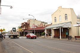
Laidley is a town situated in the Lockyer Valley of South East Queensland, Australia. The township had a population of 3,518 in 2011 and lies 83 kilometres (52 mi) west of Brisbane, the state capital.
Contents
Map of Laidley QLD 4341, Australia
The local industry has been dominated by agriculture since the end of the 19th century. Laidley has long regarded itself as "Queensland's Country Garden". Fruit and vegetable production features prominently, with the majority of beetroot grown in Australia coming from the Laidley district.
History
Allan Cunningham first explored the area in 1829. Cunningham named it Laidley's Plain after the Deputy Commissary General of the colony of New South Wales. The town developed around a wagon stop on the main road route between Ipswich and Toowoomba. A stop was needed after the climb over the small Little Liverpool Range west of Marburg.
By the 1850s the area was being cleared for sheep grazing. A survey for the growing village was conducted in 1858. Laidley Post Office opened on 1 February 1861. A Laidley Creek West Post Office was open from 1927 until 1955 (a receiving office had been open from 1899). A Laidley Rail Post Office opened in 1915 and closed in 1925. In the mid-1870s the railway line from Grandchester stopped at a railway station 1.5 kilometres (0.93 mi) north of the town. Between 1911 and 1955, a branch railway line ran from Laidley along the Laidley Creek to the settlement at Mulgowie. The town was the centre of the Shire of Laidley, a former local government area.
Heritage listings
Laidley has a number of heritage-listed sites, including:
Sport and recreation
The Laidley Golf Club is a public twelve hole course adjacent to Lake Dyer, two kilometres from the township of Laidley on Wehlow Road off Gatton-Laidley Road. Established in 1951 at its present site, the original nine holes were designed by Ross Watson. A further three holes were designed by David Burrup in 2003. The competition course has thirteen different tees for the eighteen holes while the Social Course has fifteen different tees for the eighteen holes. The "Laidley Classic" is held each year on the second week-end in April. The Classic commenced in 2011 with a Men's Event, it expanded to include a Ladies Event in 2012. In 2013 it was again expanded to a 2-day event for Men on Saturday and Sunday with a 1-day event for Ladies on Friday.
Education
Laidley District State School caters for students from Prep to Year six. It opened in January 1999.
Laidley State High School opened in 1985.